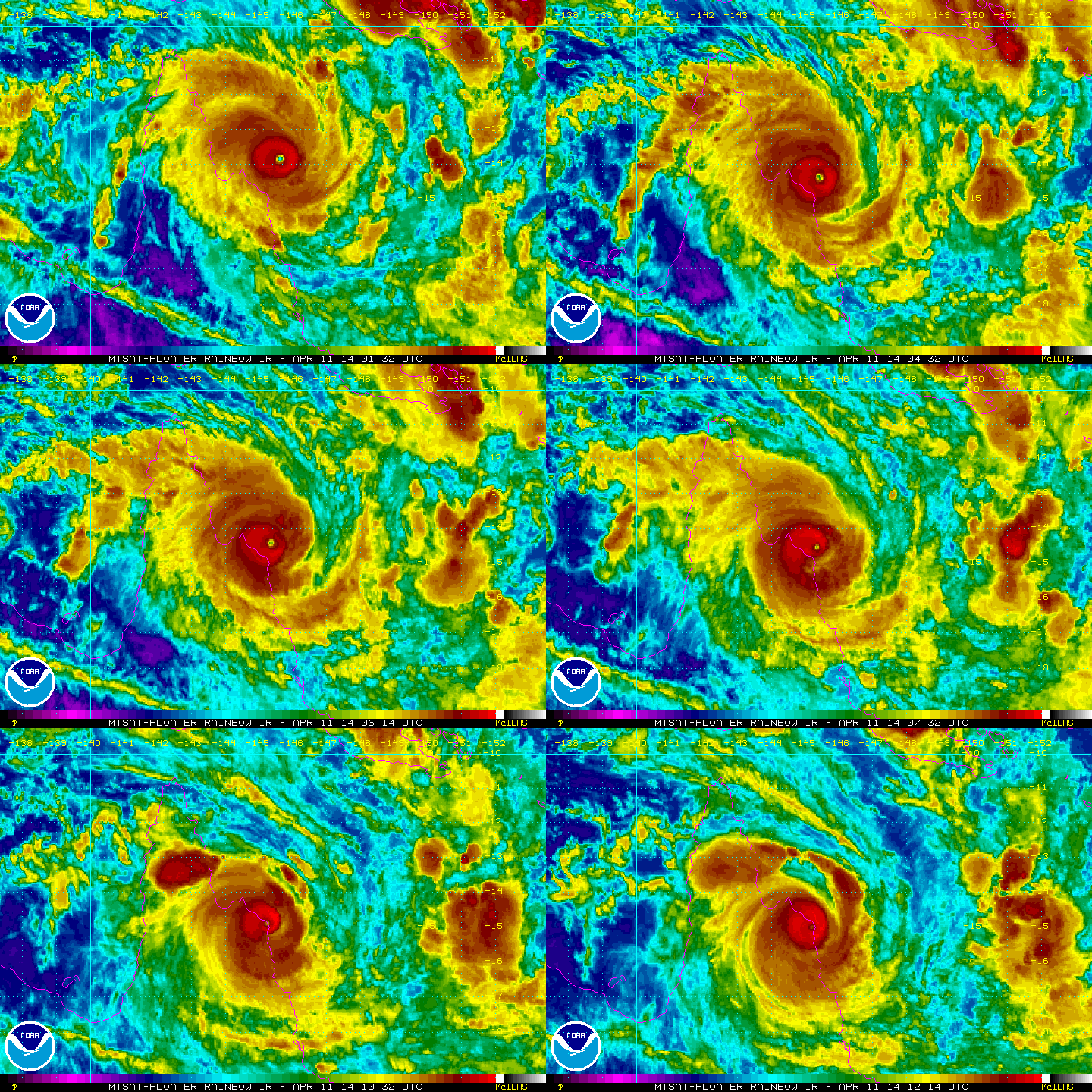
Severe Tropical Cyclone Ita
We are still a few months away from the start of the Atlantic Hurricane Season, which begins June 1. However, in the southern hemisphere, around Australia they are still in the tropical cyclone season for about another month.
A very dangerous and destructive storm is impacting parts of Australia currently. Severe Tropical Cyclone Ita made landfall earlier today along the northern Australia Coast in the state Queensland. Ita is a very powerful storm as maximum sustained winds were 135 knots or 155 mph with wind gusts to 165 knots or 190 mph. Looking at the system, there is no doubt that Ita is a very strong storm being fairly symmetrical, with a well-developed eye.
What always fascinates me about southern hemisphere storms is they spin backwards to what we are use to seeing in the northern hemisphere. In the southern hemisphere, cyclonic flow is clockwise verses the counter-clockwise flow we see in the northern hemisphere.
At 1pm EST Friday, Severe Tropical Cyclone Ita was situated over the
northwestern Coral Sea and moving south southwestwards towards the north
Queensland coast.
Severe Tropical Cyclone Ita is expected to shift inland during Saturday though
remain quite close to the coast. It will then most likely move southeastwards
off the southern tropical or central coast on Monday and into the Coral Sea. It
has some potential to redevelop though will be encountering a less favorable
environment and should also shift further southeast away from the east
Queensland coast.


