

Active Weather Tomorrow
A few important notes concerning weather in the days ahead. Today will be warm and dry with a high in the low 80s, but some big changes are ahead.
RAIN/STORMS TOMORROW: SPC has most of Alabama in the standard “slight risk” of severe weather tomorrow, with an enhanced 30% chance over the central counties…
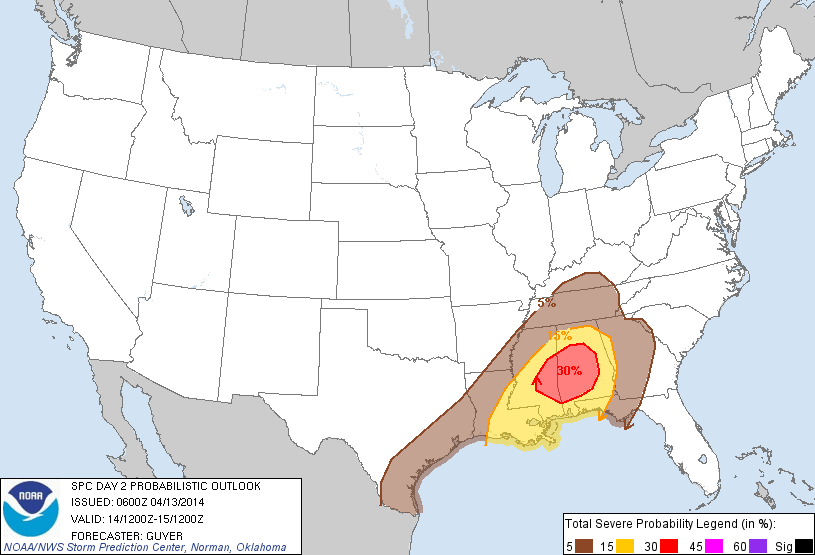
Defining the severe weather threat tomorrow is somewhat complicated. A large mass of rain is expected to move across Alabama after midnight tonight into tomorrow morning, and this will limit the amount of instability available for the “second round” later in the day. If clouds hold in place through the day, the rain cooled air will greatly limit the severe weather potential over the northern half of Alabama. The wind fields will support some risk of severe weather; we will just have to watch developments closely during the day.
I would suggest the primary threats will come from strong straight line winds and hail, although an isolated tornado can’t be ruled out.
HEAVY RAIN POTENTIAL: The high resolution NAM model hints that over two inches of rain could fall south of Birmingham tomorrow and tomorrow night…

The NWS might consider a flash flood watch this afternoon since the ground is still relatively saturated from the big rains this past Sunday night and Monday morning.
APRIL COLD SNAP: The other issue is the potential for frost/freeze Wednesday morning. Tuesday will be a raw, cold day with a chilly north wind…. sure looks like many places won’t get out of the 40s. Some possibility some communities north of Birmingham, near the Tennessee border, might even have a hard time getting out of the 30s.
Models bring temperatures down into the 30 to 35 degree range around daybreak Wednesday…
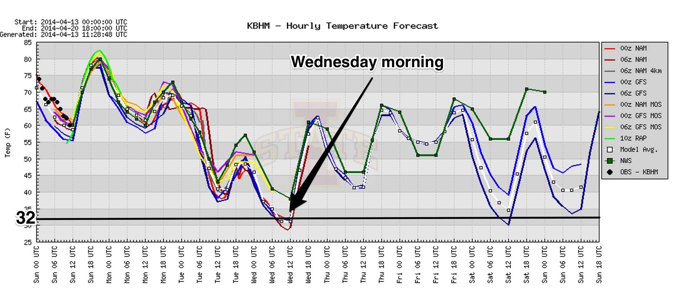
Growers will need to plan accordingly. Colder pockets over North Alabama will most likely reach the 20s.
Stay tuned for updates through the day as new model data arrives…
Category: Alabama's Weather
About the Author (Author Profile)
James Spann is one of the most recognized and trusted television meteorologists in the industry. He holds the AMS CCM designation and television seals from the AMS and NWA. He is a past winner of the Broadcast Meteorologist of the Year from both professional organizations.Subscribe
If you enjoyed this article, subscribe to receive more just like it.


