

A Nice Sunday, Severe Weather in the Offing Though
A pleasant spring Sunday is in progress with partly cloudy to occasionally mostly cloudy skies at time. High clouds are starting to stream across the area, and thickening and lowering clouds are to the west. Back over Mississippi, we see a healthy field of cumulus clouds in a plume of moisture surging up into the Magnolia State. By the time you get to the Mississippi River, a thick overcast is in place.
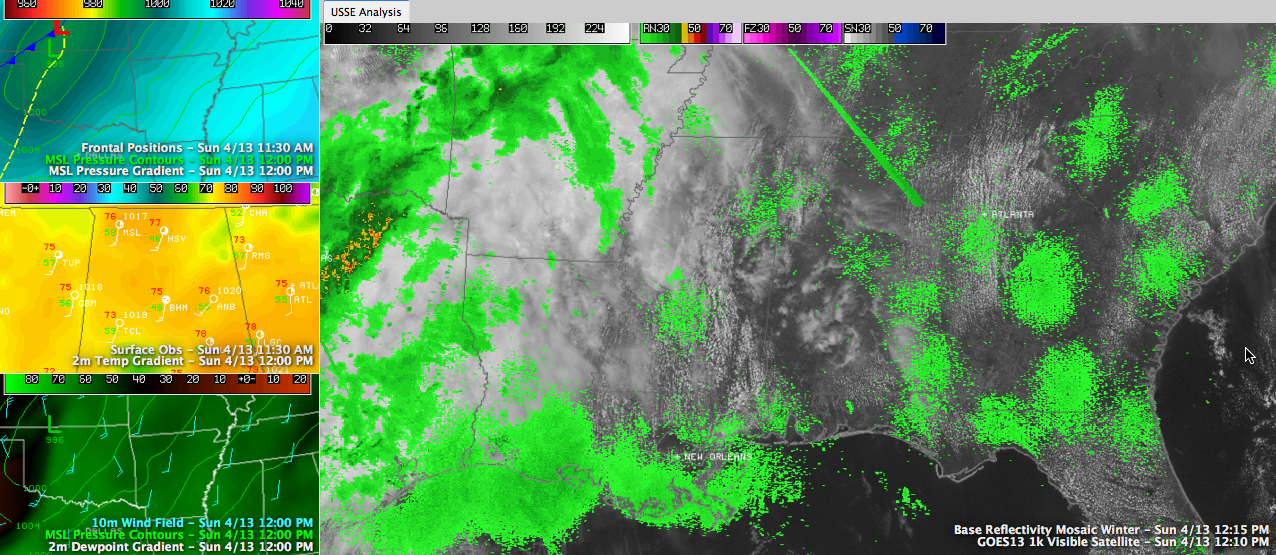
The nearest rain to Alabama is some rain over northwestern Arkansas and some showers over eastern Texas. Thunderstorms are in progress in the Dallas/Ft. Worth area, but they are not strong nor severe at this time.
Temperatures are in the upper generally at this hour. Birmingham and Anniston are at 78F and 77F respectively, Tuscaloosa checked in with 73F at noon, a little cooler since skies are already cloudy. It has become quite breezy, with southerly winds averaging 10-20 mph and gusts to near 30 mph at times.
A quick check of the weather early this afternoon shows that the forecast is on track for Central Alabama.
Severe weather is expected today and tonight to the west of Alabama. There is a large slight risk severe weather outlook area in effect today and tonight in an area roughly bounded by Austin, Wichita Falls, Oklahoma City, Wichita, Kansas City, Peoria, St. Louis, Memphis, Meridian, Alexandria and back to Austin. The moderate risk area that was included in the forecast earlier has been removed due to the clouds and precipitation over Texas and Oklahoma that is reducing instability.
The storms to our west will move eastward overnight, weakening as they move across Mississippi. They should make it into Alabama well after midnight.
As a second surface low develops to our west early tomorrow and instability rises with some daytime heating, storms should ramp up during the day. They should be enough instability and shear in place for some of the storms to become strong to severe by afternoon. It now appears that all modes of severe weather are possible, with hail, damaging winds and even tornadoes. We will be able to refine the exact threat as we move into the daylight hours tomorrow, but for now, review your severe weather safety plans and check your sources for receiving watches and warnings.
Much colder weather is in the offing for Tuesday behind the cold front. Highs will remain in the 50s all day with the threat of some frost Tuesday night as the mercury drops into the middle 30s generally with a few spots reaching freezing. Growers and planters should be aware of the threat and plan accordingly.
Category: Alabama's Weather
About the Author (Author Profile)
Bill Murray is the President of The Weather Factory. He is the site's official weather historian and a weekend forecaster. He also anchors the site's severe weather coverage. Bill Murray is the proud holder of National Weather Association Digital Seal #0001 @wxhistorianSubscribe
If you enjoyed this article, subscribe to receive more just like it.


