

Watching to the West
It is an active night of severe weather in areas to the west of Alabama as a dynamic storm system continues to come together.
As we have been advertising, it is a two prong system. The first upper disturbance is moving into Arkansas from Oklahoma tonight, weakening as it goes. Showers and storms extend from southwestern Illinois to southeastern Missouri to Central Arkansas. Further south, new development is building over Central Louisiana.
Flash flood warnings are in effect around Little Rock, where water rescues are going on at this hour from West Little Rock into downtown.
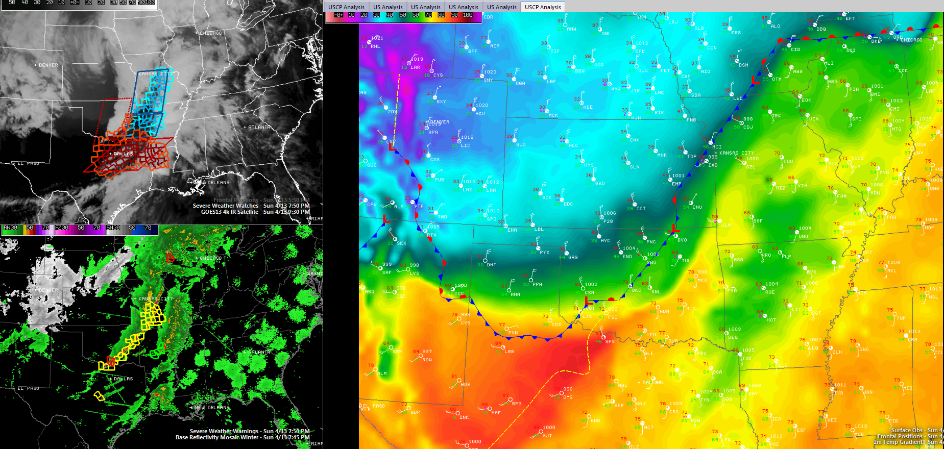
A stronger, intensifying disturbance is moving out of the Rockies tonight. This disturbance is opening the door for a big Arctic airmass to come south. That impressive boundary extends from Chicago to Des Moines to Kansas City to Oklahoma City to Amarillo.
It is 68F at Springfield MO while just a short distance on the other side of the boundary, it is 39F in Salina and 32F in Hill City KS. Just yesterday, Salina was setting a record high with 91F. In Texas, it is 81F at Wichita Falls and 51F at Pampa in the Panhandle. Further back in the cold air it is 24F in Denver with heavy snow.
The main squall line extends from Central Missouri west of St. Louis into northwestern Arkansas across southeastern Oklahoma to the Red River between Texas and Oklahoma. Severe thunderstorm warnings extend from Central Missouri into western Arkansas. A tornado warning was in efect for areas near Ardmore OK a little earlier.
There have been only three tornado reports today, including two from Iowa and one from Oklahoma.
The initial activity will push across northern Mississippi this evening and reach Northwest Alabama before sunrise. The system will be weakening as it pushes through West Alabama, reaching I-59 on mid-morning.
Meanwhile, activity should intensify over northern Louisiana, northern Mississippi and western Tennessee during the day ahead of the main trough and powerful cold front. This activity should reach Northwest Alabama by late afternoon and push through western Alabama between 6-8 p.m. and into the I-59 corridor between 7-9 p.m. It will reach eastern Alabama during the late evening. Showers and storms will continue until the cold front moves through during the predawn hours Tuesday morning.
There is a chance that instabilities will be pretty impressive over western Alabama late tomorrow afternoon. In addition, wind shear values will be high as well, In fact, 0-1 km helicities may be in the 250-300 m2/s2 range. Surface temperatures will push into the middle 70s and dewpoints should be in the middle 60s.
So, we will be monitoring the severe weather potential across Central Alabama through early Tuesday. Indications are that the threat tonight is very low. But we will keep an idea on it. The main threat should come late tomorrow afternoon through tomorrow evening. Hail and damaging winds will be possible and we can’t rule out the threat of tornadoes as well. Stay tuned.
In addition to the severe weather threat, there is a flash flooding threat. Rainfalls across Central Alabama will average 1.5-2.5 inches through Tuesday morning. Flash flood watches are in effect through Tuesday afternoon.
Category: Alabama's Weather, Severe Weather
About the Author (Author Profile)
Bill Murray is the President of The Weather Factory. He is the site's official weather historian and a weekend forecaster. He also anchors the site's severe weather coverage. Bill Murray is the proud holder of National Weather Association Digital Seal #0001 @wxhistorianSubscribe
If you enjoyed this article, subscribe to receive more just like it.


