

Early Evening Radar Check
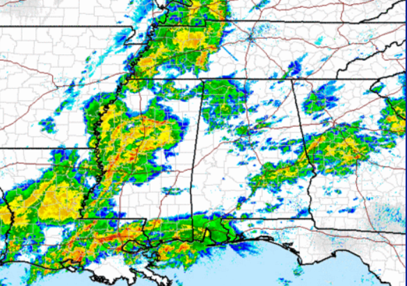
We continue to have scattered light rain across much of the state this evening. This rain will continue the next few hours. We are watching activity to our west over Central Mississippi in and around the Jackson area, where some stronger storms are ongoing currently. This activity will continue to head east through the evening and will be moving across Alabama during the overnight.
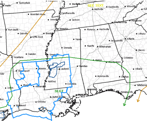
Roughly the southern third of the state remains outlined in a slight risk for severe weather. There is a severe thunderstorm watch across Mississippi and Louisiana with a few warnings in Central Mississippi. Though some of the storms are severe, we are not expecting severe storms to impact North-Central Alabama. We could see a few strong storms in the area, with gusty winds and some hail, but most locations will just see the heavy rains.
Severe storms will be possible across our southern counties and we could even see a watch issued for some of our southwestern counties, but the main concern continues to be the threat for flooding. All of Central Alabama remains under a flash flood watch until 1 PM Tuesday. With the soaking rains from earlier today and additional heavy rain set to arrive after while, we could certainly see a few flash flood warnings.
Category: Alabama's Weather
About the Author (Author Profile)
Macon, Georgia Television Chief Meteorologist, Birmingham native, and long time Contributor on AlabamaWX. Stormchaser. I did not choose Weather, it chose Me. College Football Fanatic. @Ryan_StinnetSubscribe
If you enjoyed this article, subscribe to receive more just like it.


