

Risk for Severe Weather for Parts of NW Alabama
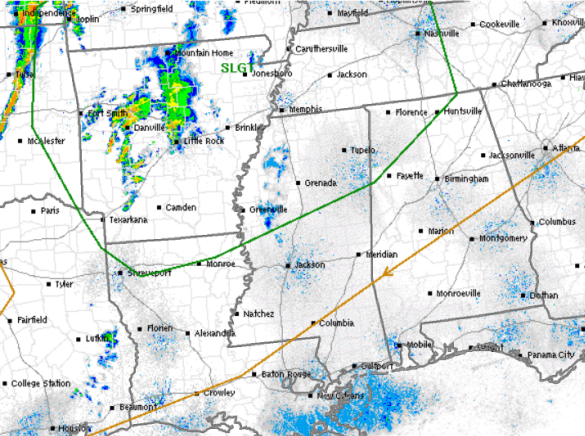
The SPC maintains a risk for severe weather across much of the Lower Mississippi Valley today. The risk area does come as far east as Alabama and includes much of the northwestern portion of the state, which has been outlined in green. The risk is valid until 7 AM Friday morning.
We are seeing some convection ongoing to our west, with a few severe storms. Heading through the rest of today, we are expecting additional showers and storms to develop and some will become severe. This activity is then expected to head east through the evening hours and should impact portions of Northwest Alabama after midnight tonight.
Areas around Red Bay, Florence, Haleyville, Decatur, and Huntsville could see some strong and locally severe storms overnight as this activity heads into the state. Hail and gusty winds will be the main threats. However, as these storms enter the state, they will be weakening and should not cause too many problems. This activity is expected to begin rapidly dissipating during the early morning hours as it pushes into and across Central Alabama. We are not expecting any severe weather for Birmingham, Tuscaloosa, Anniston, or Gadsden. The left-over convection should only be some scattered showers that will affect the area during the pre-dawn and early morning hours.
Once these showers push through in the morning, we are expecting improving conditions with mostly sunny skies and highs near 80 for you Friday.
Category: Alabama's Weather, Severe Weather
About the Author (Author Profile)
Macon, Georgia Television Chief Meteorologist, Birmingham native, and long time Contributor on AlabamaWX. Stormchaser. I did not choose Weather, it chose Me. College Football Fanatic. @Ryan_StinnetSubscribe
If you enjoyed this article, subscribe to receive more just like it.


