

Evening Update
First off there is a very dangerous tornado warned storm moving across Central Mississippi. The NWS in Jackson is tracking a confirmed tornado well north of Jackson and northeast of Yazoo City. The storm currently is in Holmes County near the town of Lexington as is approaching Interstate 55. This storm continues to move off to the east-southeast and besides producing the tornado, hail to the size of golf balls is possible.
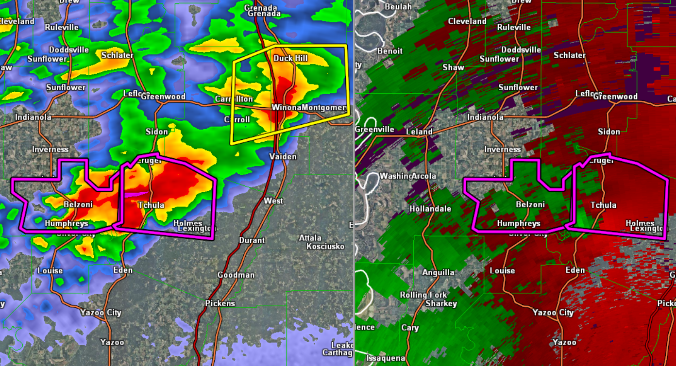
Click image to enlarge.
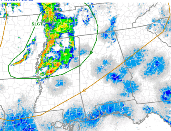
For us in Alabama, we will continue to watch the storms to our west, but the atmosphere over Alabama is more stable than over Mississippi. Instability values are higher to our west as dew points are in the mid 60s. Over Alabama there are only in the mid-50s, which are not ideal for severe storms. We are expecting the storms to be weakening as they approach the state later tonight.
The SPC maintains portions of Northwest Alabama in a slight risk for severe weather. The areas outlined in green remain under this risk until 7 AM tomorrow morning. Locations from northern Pickens County, up through Fayette, Winston, Morgan, and Limestone Counties, and areas to the north and west are in this threat. As the storms approach the state, we could see some of them produce some hail and gusty winds.
Category: Alabama's Weather, Severe Weather
About the Author (Author Profile)
Macon, Georgia Television Chief Meteorologist, Birmingham native, and long time Contributor on AlabamaWX. Stormchaser. I did not choose Weather, it chose Me. College Football Fanatic. @Ryan_StinnetSubscribe
If you enjoyed this article, subscribe to receive more just like it.


