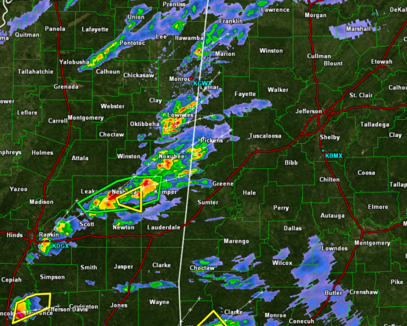
Storms Approaching Alabama
Strong and a few locally severe storms are approaching the state line. The storms approaching Lamar, Pickens, and Sumter Counties are just below severe limits and are producing some hail, gusty winds, very heavy rainfall, and frequent lightning. The storms are pulsing up and down in intensity today and are capable of reaching severe limits at any time. The dynamics today do support severe weather.
Some good news is the bulk shear values are very high today and that is causing the tops of the storms to get blown off and we are seeing some of the storms collapse some. Updrafts are strong today, and several storms have been rotating, but thankfully no tornadoe warnings have been issued with this activity.
These storms will continue to push off to the east and will be affecting Central Alabama through the evening and overnight hours. A tornado watch remains valid until 10 PM this evening for much of the area. Just like we saw yesterday, these storms will be able to intensify rapidly and could produce a few tornadoes.
The entire region remains under a flash flood watch until Wednesday morning. Very heavy rainfall and flash flooding are a threat with any storm.
Category: Alabama's Weather, Severe Weather


