

Early Afternoon Update
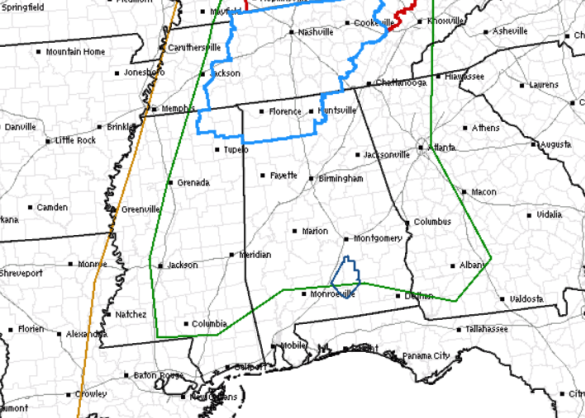
Much of the state remains under a slight risk for severe weather today (the green outline). Areas along and north of U.S. 84 from Grove Hill, to Monroeville, Andalusia, and Dothan are included in this risk. Portions of the Tennessee Valley are under a severe thunderstorm watch until 7 PM and this includes Huntsville, Decatur and the Shoals. No active watches or warnings for Central Alabama at this time, but that could of course change.
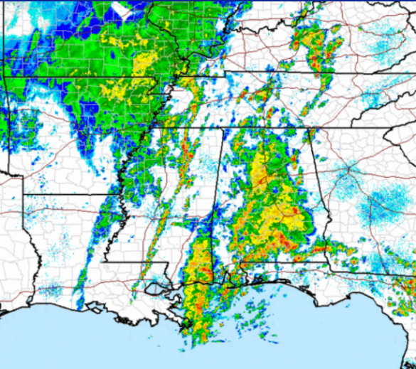
The radar has certainly lit up and filled in the last several hours as more and more showers and thunderstorms continue to develop and lift north through the state. Many locations across the state are reporting moderate to heavy rain at times. Some rumbles of thunder are being heard as well.
For the rest of the afternoon and heading into this evening, we will continue to see showers and storms develop. Cold front to the west will continue to creep into the state and will help enhance uplift that could allow for some strong and locally severe storms to develop. The main severe weather threat for Alabama will continue to be a threat for hail and damaging wind gusts. Of course we are going to have to watch rainfall rates carefully as there may be some areas that could see some flash flooding. The NWS Offices in Tallahassee and Mobile have many of their counties included in a flash flood watch, but nothing as of yet from NWS Birmingham.
Category: Alabama's Weather, Severe Weather
About the Author (Author Profile)
Macon, Georgia Television Chief Meteorologist, Birmingham native, and long time Contributor on AlabamaWX. Stormchaser. I did not choose Weather, it chose Me. College Football Fanatic. @Ryan_StinnetSubscribe
If you enjoyed this article, subscribe to receive more just like it.


