

A Cool May Day….
An all new edition of the ABC 33/40 Weather Xtreme video is available in the player on the right sidebar of the blog. You can subscribe to the Weather Xtreme video on iTunes by clicking here.
COOLER AIR BLOWS INTO ALABAMA: Nothing on the radar this morning; the big rain mass moved out of the state after midnight. Low clouds linger, but there is a chance we see some sun later today as the sky becomes partly sunny. It won’t feel like the middle of May; we don’t expect to get past the mid 60s today with a cool northwest wind of 10-20 mph. The record low maximum temperature for May 15 is 62 degrees, set in 1926. If the sun breaks out for a while, we should get past that level. But, if clouds hang tough all day, it will be a very close call.
TOMORROW: Tomorrow will be cool and dry; we begin the day in the mid 40s, and once again that is very close to record levels. The record low for Birmingham for May 16 is 43 degrees set in 1973. The sky should be partly sunny tomorrow with a high at or just over 70 degrees.
WEEKEND SHOWERS? The weekend forecast is somewhat challenging. A deep, cold core upper trough will be anchored over the eastern third of the nation, and spokes of energy will rotate through the base of the trough. The will bring cloudy periods to the northern half of Alabama, and even the chance of a little light rain. This is model output from the high resolution NAM, valid at 1:00 Saturday afternoon….
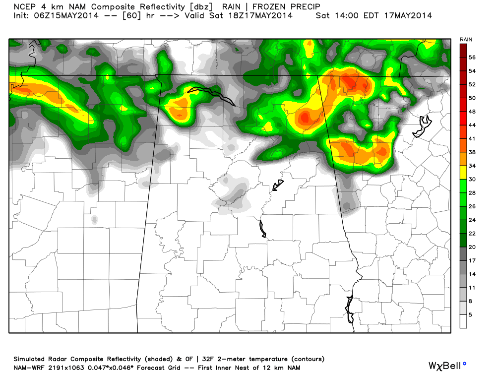
It suggests a chance of showers north of I-20, and we will need to amend the forecast to include that possibility. South of I-20 (Tuscaloosa to Birmingham to Anniston), Saturday will be rain-free.
Pretty much the same situation Sunday… a chance of showers from I-20 north, but dry over the southern half of the state. We might even see a little thunder Sunday afternoon due to the very cold air aloft making the air unstable. Highs over the weekend will be in the mid 70s.
NEXT WEEK: An upper ridge will replace the trough, and we warm back into the 80s. And, dry air means no rain Monday through Thursday with sunny days and fair nights.
See the Weather Xtreme video for the maps, graphics, and details.
WEEKEND AT THE BEACH: Perfect weather for the Hangout Music Festival in Gulf Shores this weekend with sunny days and fair nights; highs on the immediate coast will be in the upper 70s. Next week will be rain-free as well with sun filled days and highs rising into the low 80s on the coast. Sea water temperatures are generally in the mid to upper 70s.
REGIONS TRADITION GOLF TOURNAMENT: Today will be a cool, breezy day at Shoal Creek with a high only in the mid 60s; the sun should peek through at times this afternoon. Dry tomorrow, but a passing shower is possible Saturday and Sunday. Nothing heavy, and it won’t be too disruptive.
WEATHER BRAINS: Don’t forget you can listen to our weekly 90 minute netcast anytime on the web, or on iTunes. This is the show all about weather featuring many familiar voices, including our meteorologists here at ABC 33/40.
CONNECT: You can find me on all of the major social networks…
Facebook
Twitter
Google Plus
Instagram
I will be doing a weather program this morning at Vestavia Hills Cahaba Heights Elementary School… look for the next Weather Xtreme video here by 4:00 this afternoon. Enjoy the day!
Category: Alabama's Weather
About the Author (Author Profile)
James Spann is one of the most recognized and trusted television meteorologists in the industry. He holds the AMS CCM designation and television seals from the AMS and NWA. He is a past winner of the Broadcast Meteorologist of the Year from both professional organizations.Subscribe
If you enjoyed this article, subscribe to receive more just like it.


