

Quite Afternoon So Far
An all new edition of the ABC 33/40 Weather Xtreme video is available in the player on the right sidebar of the blog. You can subscribe to the Weather Xtreme video on iTunes by clicking here.
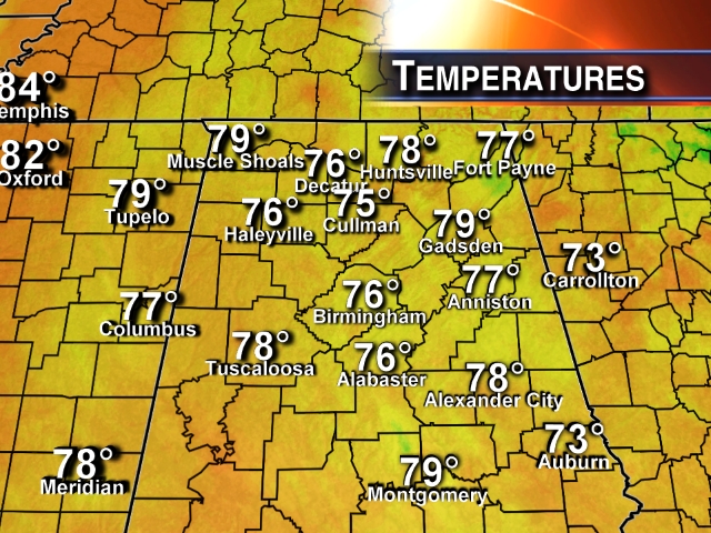
NOT MANY SHOWERS: Persistent clouds over Alabama are keeping temperatures cool, and the air stable across North and Central Alabama this afternoon. Most places are still in the 70s at mid-afternoon… amazingly comfortable for June.
A few showers could pop up over the next few hours, but it sure looks like most places will be dry.
TOMORROW: An axis of deeper moisture lingers over Alabama, and with a weak wave aloft moving into the state, we will continue to mention a chance of showers and thunderstorms, especially during the afternoon and evening hours… the high should be in the mid 80s.
WEDNESDAY: An upper high noses into the state, and the day looks mostly dry with only a slight risk of an afternoon shower. The high Wednesday afternoon will be in the upper 80s.
THURSDAY/FRIDAY: A surface front will approach from the north, and we expect a decent coverage of showers and thunderstorms both days as the upper high weakens. The best chance of storms Thursday will most likely be north of Birmingham, while all of North/Central Alabama will have a decent chance of one or two passing showers or storms Friday.
Some of the storms over North Alabama Thursday afternoon could be pretty strong with potential for gusty winds and some hail. The high Thursday and Friday will be in the 87 to 90 degree range.
OUR WEEKEND: The surface front will slowly wash out over North Alabama, and it looks like we can project some standard early June weather with partly sunny days and the risk of “scattered, mostly afternoon and evening showers and thunderstorms”. Similar weather conditions will continue into early next week.
AT THE BEACH: A few showers and storms are likely tomorrow from Panama City over to Gulf Shores, but they will thin out greatly Wednesday, and the weather Thursday through the weekend looks great with ample sunshine each day and only isolated showers or storms. Highs on the immediate coast will remain in the 80s, and sea water temperatures are mostly in the upper 70s.
TROPICS: A mass of unsettled weather is over the Gulf of Mexico, but cooler ocean water and unfavorable winds aloft there should be mean little risk of development over the next several days.
WEATHER BRAINS: Don’t forget you can listen to our weekly 90 minute netcast anytime on the web, or on iTunes. This is the show all about weather featuring many familiar voices, including our meteorologists here at ABC 33/40. We will produce this week’s show tonight at 8:30 CT… you can watch it on “James Spann 24/7” on cable systems around the state, or on the web here.
CONNECT: You can find me on all of the major social networks…
Facebook
Twitter
Google Plus
Instagram
Look for the next Weather Xtreme video here by 7:00 a.m. tomorrow….
Category: Alabama's Weather
About the Author (Author Profile)
James Spann is one of the most recognized and trusted television meteorologists in the industry. He holds the AMS CCM designation and television seals from the AMS and NWA. He is a past winner of the Broadcast Meteorologist of the Year from both professional organizations.Subscribe
If you enjoyed this article, subscribe to receive more just like it.


