

Strong Storms This Evening
**No afternoon Weather Xtreme video today due to ongoing severe weather issues**
SEVERE THUNDERSTORM WATCH: As you can see from the post below this one, SPC has issued a severe thunderstorm watch for North and East Alabama… generally north of a line from Hamilton to Cullman to Pell City and to Roanoke.
An MCS/derecho is moving into the northwest corner of Alabama as I write this… and SPC has put up a “moderate risk” of severe weather for North Alabama through the evening hours…
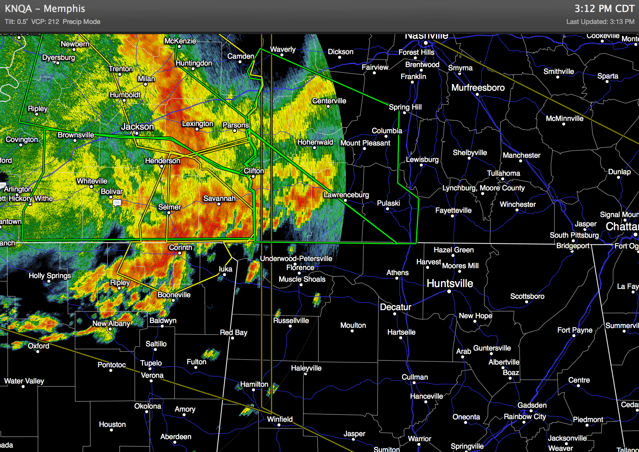
Clearly, storms over the northern third of Alabama tonight will have potential for strong, perhaps damaging straight line winds. Winds gusted to around 70 mph in the Memphis area with this derecho earlier this afternoon with a good bit of damage, and I expect to see tree and power line damage over North Alabama in coming hours as the air is very unstable.
While the highest risk of being impacted by the current derecho is along and north of U.S. 278 (Hamilton to Cullman to Gadsden), other scattered storms will form farther to the south, and those could be pretty strong as well. But, it will not rain everywhere across Central Alabama tonight… that is the nature of summer storms in Alabama.
If you are in North Alabama, but sure and pay attention to severe thunderstorm warnings this evening since the potential for high wind is elevated. Straight line winds can produce damage similar to a tornado.
The storms will settle down late tonight as the air becomes more stable.
TOMORROW: We will maintain the chance of showers and storms tomorrow as we remain on the eastern periphery of the upper high centered over Texas; another wave will move down the side of the ridge and bring a few strong storms to the state, but it won’t rain all day, and like today the sun will be out at times. The high tomorrow will be in the mid to upper 80s.
THE ALABAMA WEEKEND: Moist, unstable air will persist, and we will go with the standard summer forecast both days. Mixed sun and clouds, and the risk of scattered, mostly afternoon and evening showers and thunderstorms. Chance of any one spot getting wet both days is about one in three, and the high will be in the 87 to 90 degree range.
Very similar weather will continue next week, and if anything the coverage of the showers and storms will increase as the upper high moves westward away from us.
AT THE BEACH: Looks good from Panama City to Gulf Shores through the weekend, with mostly sunny days and fair nights. Only isolated showers with highs in the 80s. Sea water temperatures are in the 78 to 81 degree range.
WEATHER BRAINS: Don’t forget you can listen to our weekly 90 minute netcast anytime on the web, or on iTunes. This is the show all about weather featuring many familiar voices, including our meteorologists here at ABC 33/40.
CONNECT: You can find me on all of the major social networks…
Facebook
Twitter
Google Plus
Instagram
Stay tuned to the blog for running updates on the severe weather potential this evening…
Category: Alabama's Weather
About the Author (Author Profile)
James Spann is one of the most recognized and trusted television meteorologists in the industry. He holds the AMS CCM designation and television seals from the AMS and NWA. He is a past winner of the Broadcast Meteorologist of the Year from both professional organizations.Subscribe
If you enjoyed this article, subscribe to receive more just like it.


