

Storms To Start The Day
An all new edition of the ABC 33/40 Weather Xtreme video is available in the player on the right sidebar of the blog. You can subscribe to the Weather Xtreme video on iTunes by clicking here.
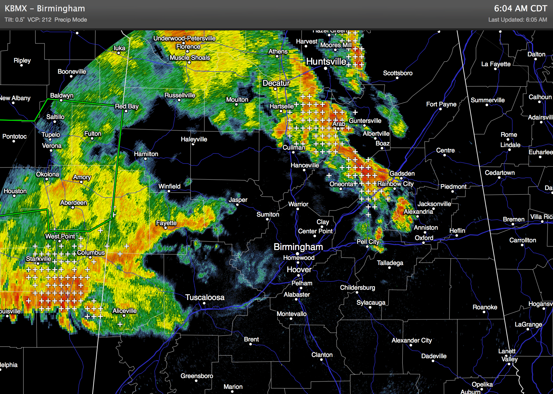
WET START: The unsettled weather pattern continues across Alabama with showers and storms in progress at daybreak in many locations. The storms are not severe by classic definition, but they are producing heavy rain in spots and a good bit of lightning as they move east.
Showers and storms should die down later this morning, but additional thunderstorm development is possible this afternoon and tonight as a moist, unstable airmass remains over Alabama. The afternoon and evening storms should be rather scattered in nature; the coverage will be really determined by how the morning storms impact the airmass. We don’t expect to get past the mid 80s today.
TOMORROW/WEDNESDAY: We will continue to mention scattered to numerous showers and thunderstorms, with an upper trough to the west and moist air in place. Impossible to give you start/stop times of the rain for any specific point, but just be ready for a shower or storm at just about any hour. Also, SPC maintains the standard “slight risk” of severe weather for North and West Alabama tomorrow, as the storms will be capable of producing some hail along with strong, gusty winds. Highs will remain in the mid 80s, although a few communities on Wednesday might hold in the 70s all day.
THURSDAY/FRIDAY: Showers and storms should become more widely spaced on these days as the air aloft becomes warmer, and the becomes a little more stable. The sky will be partly sunny, and highs will be in the mid to upper 80s. Chance of any one spot seeing an afternoon shower or storm will be about one in three.
THE WEEKEND AHEAD: Looks pretty decent. The upper trough axis will be west of the state, and the sky should be partly to mostly sunny Saturday and Sunday with only widely scattered afternoon storms. Highs rise into the upper 80s. This drier pattern should hold into early next week.
AT THE BEACH: Mostly sunny today along the coast from Panama City to Gulf Shores. Scattered thunderstorms return tomorrow through Thursday; the highest coverage of showers will be on Wednesday, most likely. Then, for Friday and the weekend, about 7 to 9 hours of sunshine each day with only widely scattered showers or storms. Highs will be in the 80s on the immediate coast, and the sea water temperature this morning at the Dauphin Island Sea Lab is 84 degrees.
TROPICS: All is quiet across the Atlantic basin, and tropical storm formation is not expected this week.
WEATHER BRAINS: Don’t forget you can listen to our weekly 90 minute netcast anytime on the web, or on iTunes. This is the show all about weather featuring many familiar voices, including our meteorologists here at ABC 33/40. We will produce this week’s show tonight at 8:30 CT… you can watch it on “James Spann 24/7” on cable systems around the state, or on the web here.
CONNECT: You can find me on all of the major social networks…
Facebook
Twitter
Google Plus
Instagram
Look for the next Weather Xtreme video here by 4:00 this afternoon… enjoy the day!
Category: Alabama's Weather
About the Author (Author Profile)
James Spann is one of the most recognized and trusted television meteorologists in the industry. He holds the AMS CCM designation and television seals from the AMS and NWA. He is a past winner of the Broadcast Meteorologist of the Year from both professional organizations.Subscribe
If you enjoyed this article, subscribe to receive more just like it.


