

Active Storms Tonight/Tomorrow
An all new edition of the ABC 33/40 Weather Xtreme video is available in the player on the right sidebar of the blog. You can subscribe to the Weather Xtreme video on iTunes by clicking here.
RADAR CHECK: Pretty quiet as I write this; just a few isolated showers are showing up over West Alabama; we have a mix of sun and clouds with temperatures generally in the low and mid 80s.
TO THE WEST: A tornado watch is in effect for parts of the Mid-South, including the Memphis area, through 7 p.m. An organized batch of storms is moving our way, and these should roll into West Alabama tonight around 8:00 p.m… with the line moving steadily to the east impacting much of North and Central Alabama.
This is the HRRR model valid tonight at 9:00…
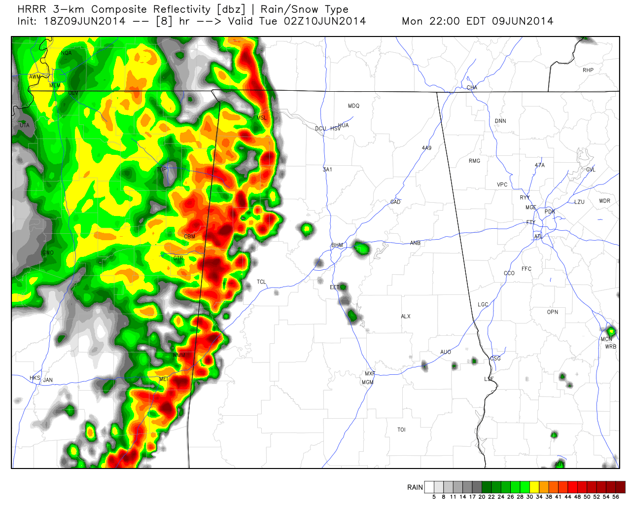
The storms could be strong to severe as they enter West Alabama tonight; the main threat will come from hail and strong straight line winds. But, the storms should weaken later tonight as they move into East Alabama and a more stable airmass.
TOMORROW: SPC has most of North and Central Alabama in the standard “slight risk” of severe weather as a dynamic weather system over the Southern Plains gets closer. Storms will form tomorrow afternoon, and those could pack a punch as well with the risk of hail and strong winds. This is not tornado season, and I don’t expect a big issue, but the tornado threat tomorrow is not zero with such good upper air support.
And, in addition to the risk of severe storms, some flooding is certainly possible through the next 60 hours. This is the projected rain through Wednesday evening at 7:00 via the high resolution NAM model, suggest rain amounts of 3 inches possible around here.
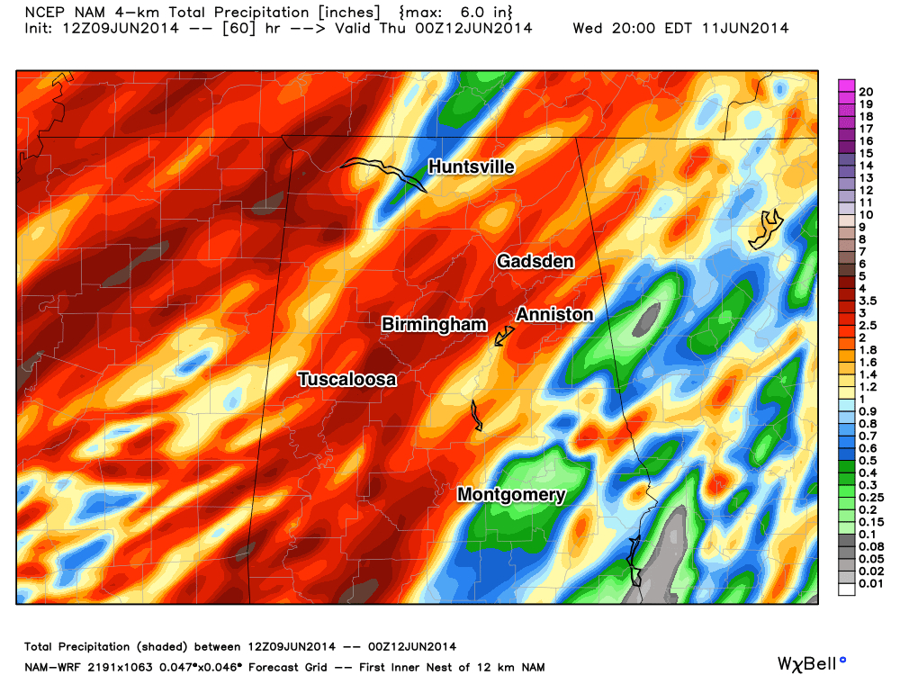
The NWS in Huntsville has issued a flash flood watch for their county warning area up in the Tennessee Valley.
REST OF THE WEEK: We will maintain a good chance of scattered to numerous showers and storms on Wednesday, but they should thin out a big Thursday and Friday as the air aloft becomes a little warm, and the air a little more stable.
OUR WEEKEND: Looks pretty decent… partly sunny days with a few widely scattered showers and storms around Saturday and Sunday afternoon. Highs back into the upper 80s. This drier pattern should hold into early next week. See the Weather Xtreme video for the maps, graphics, and details.
AT THE BEACH: Look for a general increase in the number of showers and thunderstorms through mid-week along the coast from Panama City over to Gulf Shores, but there will be some decent intervals of sunshine along the way. Then, showers become fewer in number by Friday and the weekend with a good supply of sunshine each day. Highs on the immediate coast will remain in the 80s, and the sea water temperatures are mostly in the low 80s now.
WEATHER BRAINS: Don’t forget you can listen to our weekly 90 minute netcast anytime on the web, or on iTunes. This is the show all about weather featuring many familiar voices, including our meteorologists here at ABC 33/40. We will produce this week’s show tonight at 8:30 CT… you can watch it on “James Spann 24/7” on cable systems around the state, or on the web here.
CONNECT: You can find me on all of the major social networks…
Facebook
Twitter
Google Plus
Instagram
Look for the next Weather Xtreme video here by 7:00 a.m. tomorrow…
Category: Alabama's Weather
About the Author (Author Profile)
James Spann is one of the most recognized and trusted television meteorologists in the industry. He holds the AMS CCM designation and television seals from the AMS and NWA. He is a past winner of the Broadcast Meteorologist of the Year from both professional organizations.Subscribe
If you enjoyed this article, subscribe to receive more just like it.


