

Severe Weather Risk Mainly East Alabama
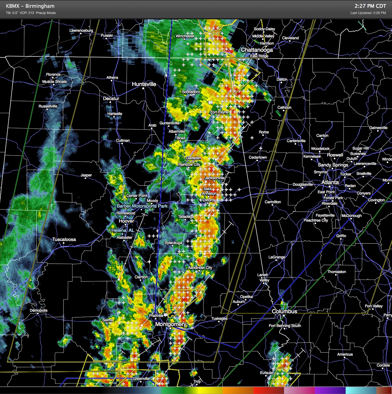
The damaging wind potential remains high for eastern Alabama generally along and east of a line from Fort Payne to Montgomery. Severe Thunderstorm Watch #273 remains in effect until 6 pm for a large portion of this area.
Radar continued to show a squall line extending from just southwest of Chattanooga southward through the Anniston-Oxford area to about Montgomery. The individual thunderstorms were moving northeast at 30 to 35 mph while the overall area of storms continued to advance slowly eastward.
Ahead of the squall line, clouds broke during the late morning allowing some extra sunshine with temperatures along the Georgia/Alabama line running right around 90 degrees. Dew points continued to be high, too, with values mainly in the lower 70s.
Risk for damaging wind along with some large hail will continue across the eastern half of Alabama into the latter part of the afternoon. There also remains a risk for isolated tornadoes.
-Brian-
Category: Alabama's Weather, Severe Weather
About the Author (Author Profile)
Brian Peters is one of the television meteorologists at ABC3340 in Birmingham and a retired NWS Warning Coordination Meteorologist. He handles the weekend Weather Xtreme Videos and forecast discussion and is the Webmaster for the popular WeatherBrains podcast.Subscribe
If you enjoyed this article, subscribe to receive more just like it.


