

Severe Weather Threat Winds Down
An all new edition of the ABC 33/40 Weather Xtreme video is available in the player on the right sidebar of the blog. You can subscribe to the Weather Xtreme video on iTunes by clicking here.
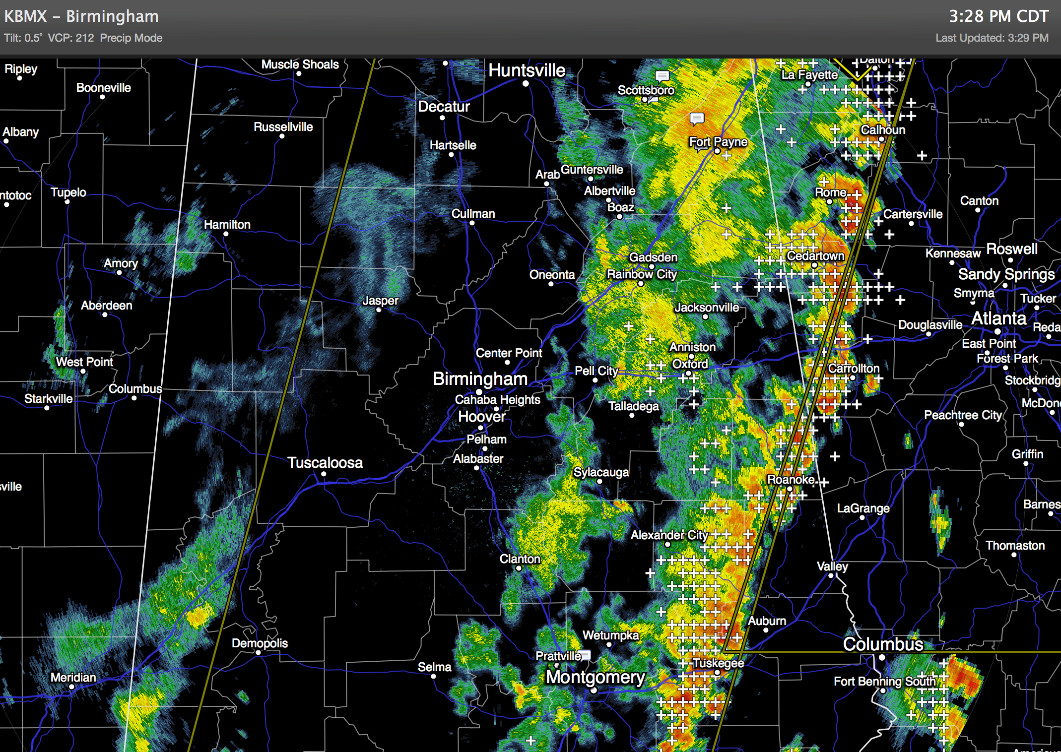
HEAVIER STORMS MOVING INTO GEORGIA: Most of the state made it through the storms this afternoon unscathed… the line of strong storms is pushing into Georgia as I write this at mid-afternoon.
Lingering showers will taper off this evening across Alabama. More storms could arrive later tonight, but they are not expected to be severe.
TOMORROW: An upper trough will rotate through the state, and we will continue to mention scattered to numerous showers and thunderstorms. While we don’t expect any organized severe weather, we might hear of a few reports of small hail because of colder air aloft associated with the upper trough. The sky will be generally cloudy, and the high will be only in the low 80s.
THURSDAY/FRIDAY: These days should feature some typical June weather… partly sunny days with the risk of “scattered, mostly afternoon and evening showers and thunderstorms”. Highs in the mid 80s Thursday, and upper 80s Friday… chance of any one spot getting wet is about one in three.
THE ALABAMA WEEKEND: Another upper trough will approach Saturday, and it looks like that will bring an increase in the number of showers and thunderstorms as the weekend begins. More clouds than sun, and a high Saturday in the mid to upper 80s. Then, Sunday looks brighter and drier with ample sunshine and just a few widely scattered showers and storms during the afternoon and evening hours. Sunday’s high should be in the upper 80s.
NEXT WEEK: The GFS model continues to develop an upper high over the Deep South, meaning mostly hot and dry weather for the first half of the week. A few afternoon storms could show up, but most likely they will be few and far between. Highs in the low 90s… see the Weather Xtreme video for the maps, graphics, and details.
AT THE BEACH: Look for an increase in the number of scattered showers and storms from Panama City over to Gulf Shores tomorrow and Thursday, but the weather looks pretty good Friday and over the weekend, with about 7 to 9 hours of sunshine each day along with some risk of widely scattered thunderstorms. Highs will remain in the 80s; the sea water temperature at the Dauphin Island Sea Lab is up to 85 degrees.
CONNECT: You can find me on all of the major social networks…
Facebook
Twitter
Google Plus
Instagram
WEATHER BRAINS: Don’t forget you can listen to our weekly 90 minute netcast anytime on the web, or on iTunes. This is the show all about weather featuring many familiar voices, including our meteorologists here at ABC 33/40.
Look for the next Weather Xtreme video here by 7:00 a.m. tomorrow….
Category: Alabama's Weather
About the Author (Author Profile)
James Spann is one of the most recognized and trusted television meteorologists in the industry. He holds the AMS CCM designation and television seals from the AMS and NWA. He is a past winner of the Broadcast Meteorologist of the Year from both professional organizations.Subscribe
If you enjoyed this article, subscribe to receive more just like it.


