

More Storms Overnight?
Here is an update on the Alabama weather situation:
Thunderstorms plagued Alabama again today, but damage was limited to 7 wind damage and 1 large hail report over Northeast Alabama and 3 wind damage reports over South Central Alabama. Those storms are into eastern Georgia, northwestern South Carolina and western North Carolina.
We are tracking two areas of storms here in Alabama tonight. One is over Southwest Alabama’s Baldwin County, moving into the Pensacola area. The heaviest weather is staying close to the beaches. The northern extent of this area of storms has been falling apart as it tried to edge northeastward. The likely reason for the weakening is some convective inhibition that is over almost all of the rest of Alabama.
Over Mississippi, a line of storms has formed from about 50 miles west of Columbus to near Jackson. They developed in a spoke of vorticity rotating around the big upper low near St. Louis. These storms will run into that convective inhibition over Alabama, as well as a lack of instability and should fall apart.
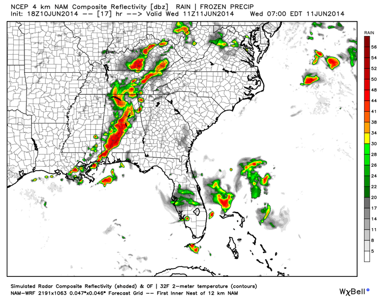
One of our main mesoscale models develops another bands of rain and thunderstorms overnight over Alabama. There is a decent 850mb jet extending from the Louisiana coast into Northwest Alabama. This could funnel warm, moist air ahead into the storms like a conveyor belt overnight and make the storms happen. Severe weather is not expected, but if the storms do form, there will be heavy rain and lots of thunder where the storms do develop.
Here is the 4 km NAM at 6 a.m. tomorrow morning:
The HRRR does show a developing band of showers over South Alabama east of I-65 and south of I-85 after midnight. The model output is not out far enough now to show what will happen beyond that.
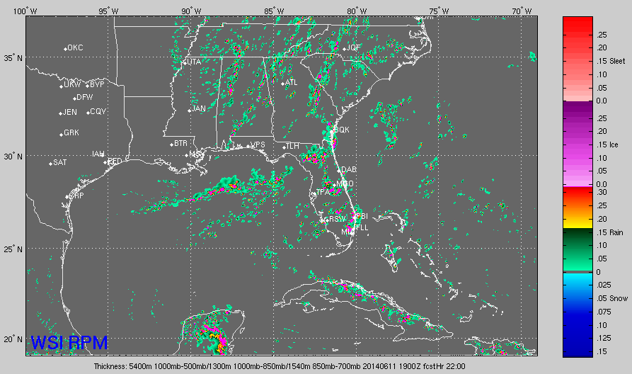
The RPM doesn’t buy into the idea of a band of storms overnight. It develops numerous showers across the area during the day tomorrow, showing the upper low moving into northern Mississippi. Here is that model’s forecast radar for tomorrow at 2 p.m.
The GFS shows high rain chances again tomorrow as the upper trough slowly slides into North Alabama.
We will be watching.
Category: Alabama's Weather, Severe Weather
About the Author (Author Profile)
Bill Murray is the President of The Weather Factory. He is the site's official weather historian and a weekend forecaster. He also anchors the site's severe weather coverage. Bill Murray is the proud holder of National Weather Association Digital Seal #0001 @wxhistorianSubscribe
If you enjoyed this article, subscribe to receive more just like it.


