

More Storms Late Tonight/Early Friday
It is not hard to find our upper low this morning. It still shows up clearly in regional radar mosaics and visible satellite imagery over North Georgia. You can see that in the larger panel of the graphic.
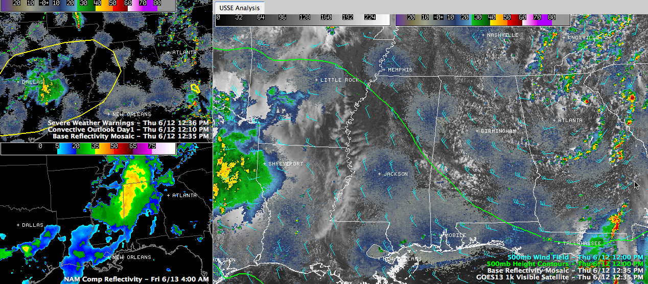
Click image to enlarge.
There is one severe thunderstorm warning over South Georgia, but it is of no consequence to Alabama.
To the west, there is a large slight risk severe weather outlook from Central Mississippi back into Texas. A complex of thunderstorms over East Texas will spread eastward into increasingly unstable air and will produce a threat of severe weather across much of Louisiana , southern Arkansas and into western Mississippi tonight.
You can see the severe weather outlook and current radar in the top left panel of the graphic.
Temperatures are climbing through into or through the lower 80s now across Central Alabama. There is a nice field of cumulus clouds developing in the slightly unstable air over the state in the wake of the upper low. There could be a few isolated showers and storms this afternoon, but precipitation coverage will be around 20% or less.
The Texas storms will limp into Alabama after midnight, weakening a bit as they go and organized severe weather is not expected. Look at the lower left panel to see the NAM’s output for what the radar might look like at 4 a.m.
Category: Alabama's Weather, Severe Weather
About the Author (Author Profile)
Bill Murray is the President of The Weather Factory. He is the site's official weather historian and a weekend forecaster. He also anchors the site's severe weather coverage. Bill Murray is the proud holder of National Weather Association Digital Seal #0001 @wxhistorianSubscribe
If you enjoyed this article, subscribe to receive more just like it.


