

Another Storm, Same Place As Yesterday
WINDS GUST TO 43 MPH AT BHM
Winds gusted to 43 mph at the Birmingham Shuttlesworth International Airport at 3:51. The temperature fell from 88F to 80F.
The storm is now weakening. Heavy rain drifted south over I-59 between the I-20 interchange and Oporto Madrid Blvd.
ORIGINAL POST 3:58
Interestingly, in almost a repeat performance of yesterday, a heavy thunderstorm has developed over northern portion of the Birmingham Metro. The storm was centered near and just east of Tarrant.
A small area just north of the Airport has probably picked up an inch of rain in less than 45 minutes.
The NWS has issued an Urban and Small Stream Flood Advisory for this area, including Tarrant City and Center Point as the storm remains stationary or drifts slowly north.
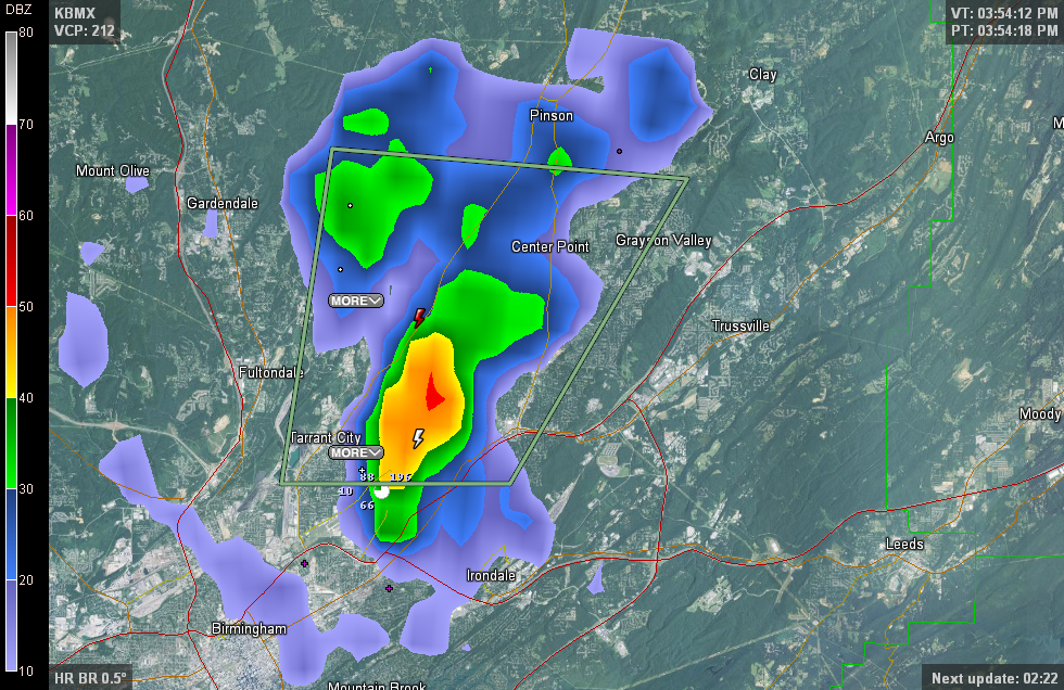
The storm is maintaining intensity for now. A smaller pulse storm to the north already collapsed and weakened, but the outflow from that storm actually caused this one to intensify. Downtown is probably feeling a rush of cool air from the outflow.
More storms are well southeast of Birmingham, in the area generally between Auburn and Columbus GA, with others to the northwest of Tuskegee.
Category: Alabama's Weather
About the Author (Author Profile)
Bill Murray is the President of The Weather Factory. He is the site's official weather historian and a weekend forecaster. He also anchors the site's severe weather coverage. Bill Murray is the proud holder of National Weather Association Digital Seal #0001 @wxhistorianSubscribe
If you enjoyed this article, subscribe to receive more just like it.


