

A Few Showers/Storms Later Today
An all new edition of the ABC 33/40 Weather Xtreme video is available in the player on the right sidebar of the blog. You can subscribe to the Weather Xtreme video on iTunes by clicking here.
HIT AND MISS STORMS: The overall weather pattern just won’t change much for Alabama through the weekend. The sun will be out at times, and we will deal with a few scattered showers and thunderstorms. The tricky part of the forecast is handling the placement, timing, and coverage of the scattered storms.
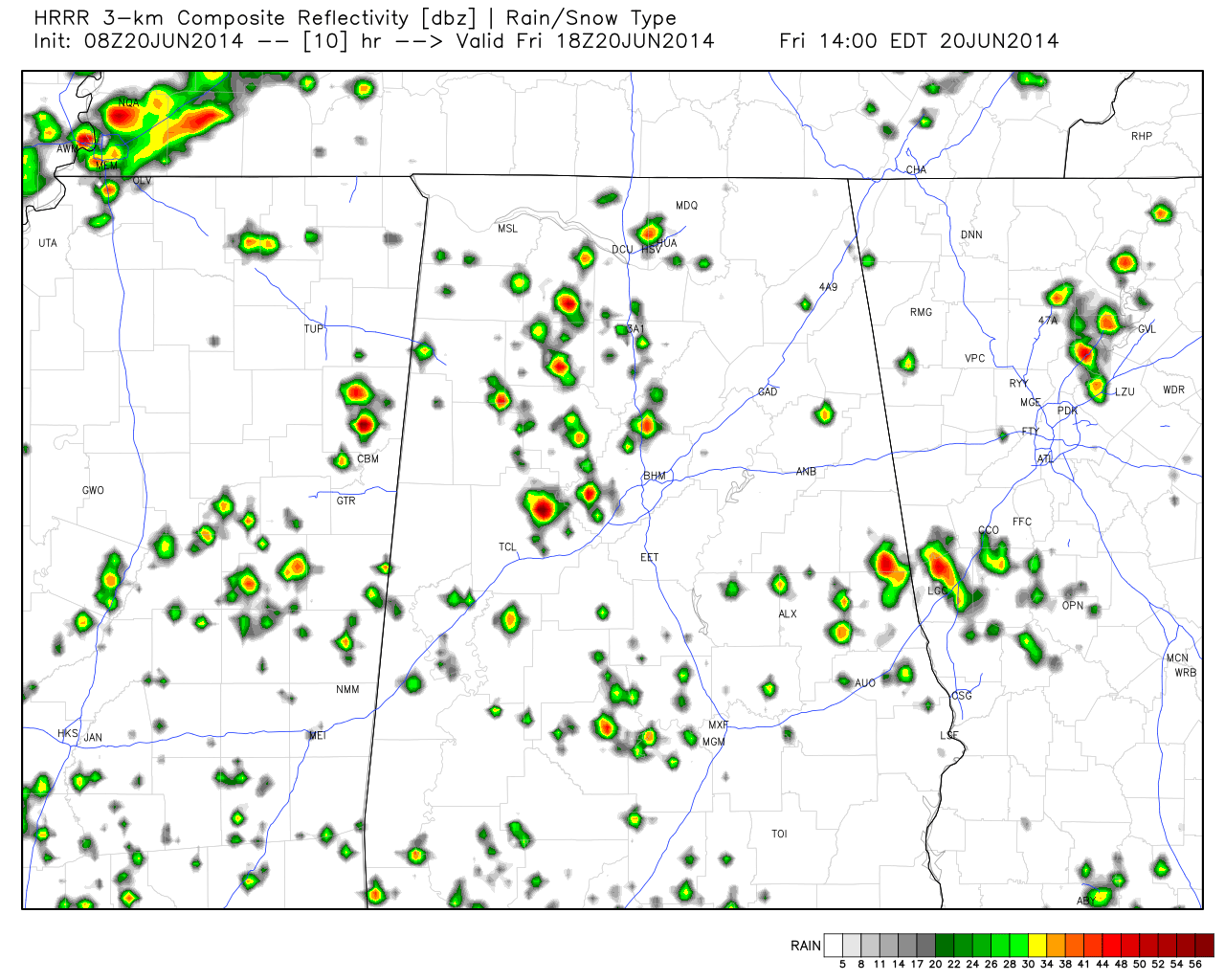
About a one in four risk of any one spot seeing a shower or thunderstorm this afternoon… below is the output from the high resolution HRRR model at 1:00 today.
THE WEEKEND: Tomorrow the upper high will be west of Alabama, and we see evidence in high res models that a wave rotating around the high could kick off a few showers or storms tomorrow morning, and we will just mention a risk of scattered showers/storms at any time tomorrow with a mix of sun and clouds. It certainly won’t rain all day, but a passing shower or thunderstorm will be possible at just about any hour. The high will remain close to 90 degrees.
Then, on Sunday, both the GFS and the NAM look relatively dry for North/Central Alabama thanks to mid-level dry air that moves in from the north. We won’t take out the chance of rain, but it looks like afternoon storms Sunday could be few and far between. The sky will be partly sunny with a high at or just over 90 degrees in most locations.
NEXT WEEK: The weather will trend wetter as the upper high retreats to West Texas, and a surface front approaches from the north. Storms Monday will remain scattered, but we expect scattered to numerous showers and thunderstorms Tuesday through Friday as the front stalls out north of the state, and the air remains pretty unstable. And, with the increase in clouds and showers, highs should drop back into the upper 80s by mid-week. See the Weather Xtreme video for the maps, graphics, and details.
GULF COAST WEATHER: About 7 to 9 hours of sunshine each day through Tuesday from Panama City west to Gulf Shores with just a few widely scattered storms around. Showers will increase a bit by Wednesday and Thursday of next week, but there will still be a pretty decent amount of sunshine. Highs on the immediate coast will be in the upper 80s; lows 90s inland. And, sea water temperatures are up into the mid and upper 80s now.
TROPICS: A weak disturbance east of Daytona Beach will drift north, and development is not expected there, or anywhere else across the Atlantic basin through the weekend.
WEATHER BRAINS: Don’t forget you can listen to our weekly 90 minute netcast anytime on the web, or on iTunes. This is the show all about weather featuring many familiar voices, including our meteorologists here at ABC 33/40.
CONNECT: You can find me on all of the major social networks…
Facebook
Twitter
Google Plus
Instagram
Look for the next Weather Xtreme video here by 4:00 this afternoon… enjoy the day…
Category: Alabama's Weather
About the Author (Author Profile)
James Spann is one of the most recognized and trusted television meteorologists in the industry. He holds the AMS CCM designation and television seals from the AMS and NWA. He is a past winner of the Broadcast Meteorologist of the Year from both professional organizations.Subscribe
If you enjoyed this article, subscribe to receive more just like it.


