

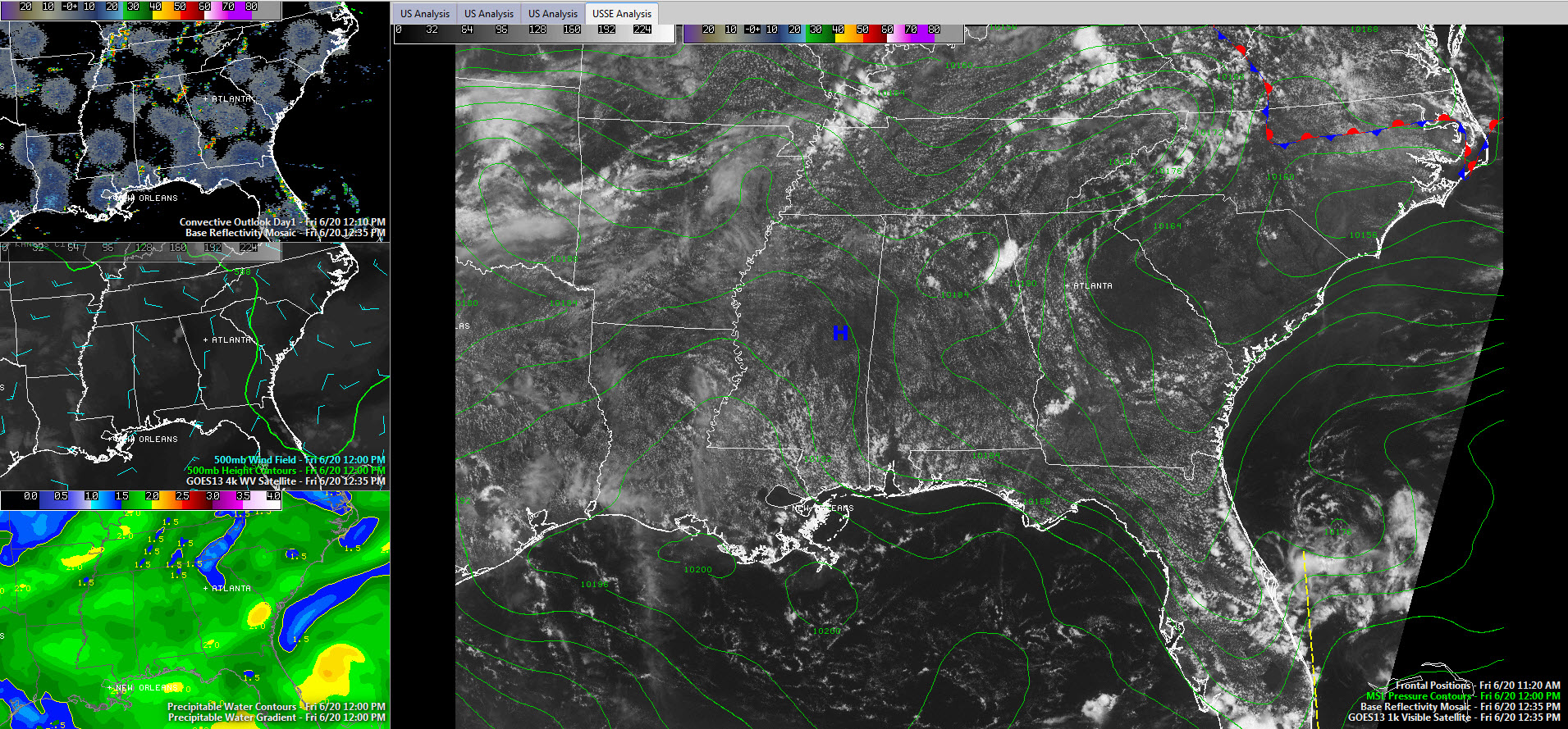
Showers and Storms Form
Showers and thunderstorms formed quickly late this morning across the northern half of Alabama, especially for areas east of US-78 and 280.
Click image to enlarge
The heaviest concentration is over Northeast Alabama. Here, a northwesterly low level flow was picking up a bit of a lift from two things: the topography of the Appalachian foothills and a bit of a wedge airmass that has worked down the eastern side of the mountains.
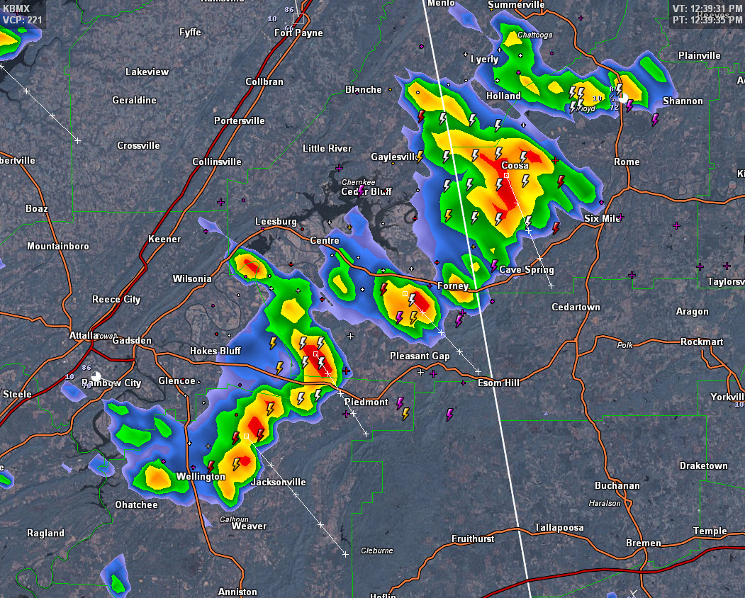
In Northeast Alabama, heavy showers and storms extended from Wellington and Jacksonville to northwest of Piedmont and Forney. They are pushing southeast at 10-15 mph and contain gusty winds, heavy rain and lightning. There could even be some small hail.
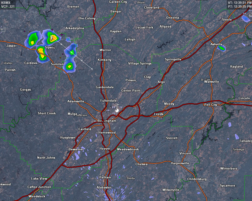
To the northwest of Birmingham, storms were forming over eastern Walker County. These cells are not enjoying the same extra lift that the Northeast Alabama storms are, but they will probably hold together. As they push southeast, they will affect parts of the Birmingham Metro area.
The storms shouldn’t become severe, but can’t rule that possibility out completely.
Category: Alabama's Weather
About the Author (Author Profile)
Bill Murray is the President of The Weather Factory. He is the site's official weather historian and a weekend forecaster. He also anchors the site's severe weather coverage. Bill Murray is the proud holder of National Weather Association Digital Seal #0001 @wxhistorianSubscribe
If you enjoyed this article, subscribe to receive more just like it.


