

Severe Thunderstorm Warning for Western Cullman Co til 515pm

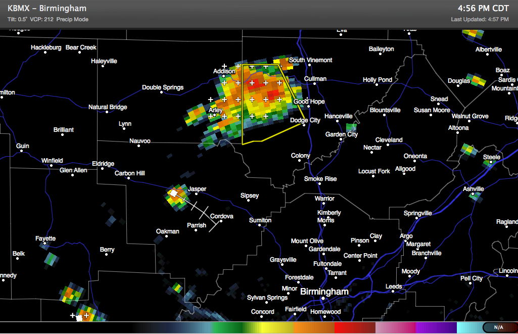
A strong storm is over western Cullman County at this hour, moving south southeast in the general direction of Dodge City. It will pass well south of the city of Cullman and just west of Good Hope.
Here is the radar as of 4:47:
Quarter sized hail and damaging winds are possible. Torrential rains and deadly lightning will accompany the storm as well.
THE NATIONAL WEATHER SERVICE IN HUNTSVILLE HAS ISSUED A
* SEVERE THUNDERSTORM WARNING FOR…
WESTERN CULLMAN COUNTY IN NORTH CENTRAL ALABAMA…
* UNTIL 515 PM CDT
* AT 446 PM CDT…DOPPLER RADAR INDICATED A SEVERE THUNDERSTORM
CAPABLE OF PRODUCING QUARTER SIZE HAIL AND DAMAGING WINDS IN
EXCESS OF 60 MPH. THIS STORM WAS LOCATED NEAR JONES CHAPEL…
AND MOVING SOUTH AT 20 MPH.
* LOCATIONS IMPACTED INCLUDE…
DODGE CITY…SARDIS…JONES CHAPEL…CRANE HILL…LOGAN AND SMITH
LAKE.
Category: Alabama's Weather, Severe Weather
About the Author (Author Profile)
Subscribe
If you enjoyed this article, subscribe to receive more just like it.


