

Subtle Boundary Triggers Rogue Storms
Scroll down for Brian’s excellent as always morning discussion.
Checking radar trends early on this Sunday morning, a couple of thunderstorms developed on some sort of southward moving boundary that was evident in radar reflectivity this morning. It appears to be the leading edge of an area of slightly drier air that has seeped southwestward into the state thanks to retreating high pressure to our southwest and the circulation around a weak area of low pressure that developed near the North Carolina coast.

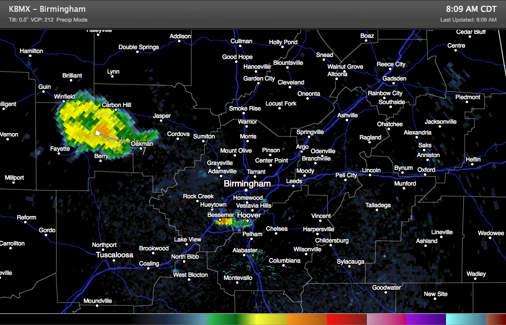
One over Marion County dumped heavy rain and caused lots of lightning for a brief time. Moderate rain is all that is left now and it is moving through Fayette and western Walker Counties between Carbon Hill and Fayette and Berry.
Another small storm flared briefly over western Jefferson County near Hueytown, but quickly weakened as it moved toward Ross Bridge. lightning has died down with this cell but some moderate rain will affect I-459 between Hoover and McCalla.
Elsewhere, there is a good bit of cloudiness over Central Alabama. Temperatures are in the 70s. Behind the boundary, dewpoints are in the upper 60s, with lower 70s to the southwest. A little bit of instability was found ahead of the boundary which led to the storms.
If that boundary is for real today, it could do one of two things. It could mean fewer storms north of US-82. Or it could mean any storms that do form will have the potential to produce strong downburst winds due to a little drier air aloft. The HRRR and 4km NAM models side with the former. That is pretty much what the current forecast says: best chances for rain today in places like Tuscaloosa, Demopolist and Montgomery.
Highs will be near 90F.
Category: Alabama's Weather
About the Author (Author Profile)
Bill Murray is the President of The Weather Factory. He is the site's official weather historian and a weekend forecaster. He also anchors the site's severe weather coverage. Bill Murray is the proud holder of National Weather Association Digital Seal #0001 @wxhistorianSubscribe
If you enjoyed this article, subscribe to receive more just like it.


