

West Alabama Storms Packing a Punch
Thunderstorms over West Alabama are packing quite a punch from Pickens through much of Greene, Hale, southwestern Perry, western Dallas and northern Marengo Counties.
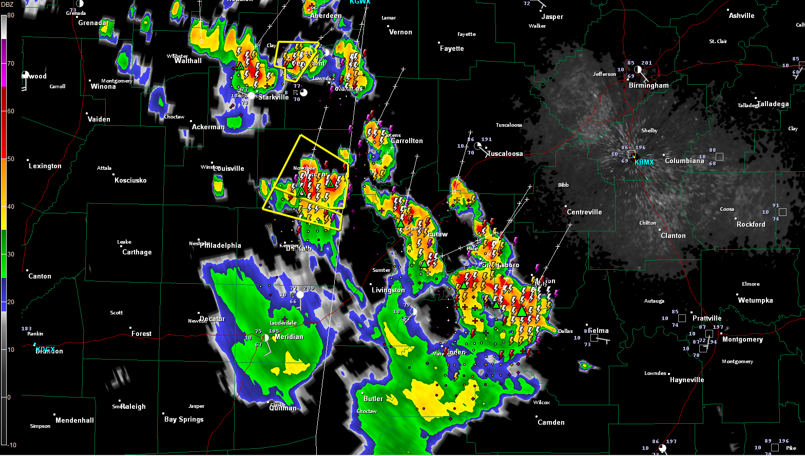
Click image to enlarge.
Places like Carrollton, Eutaw, Grensboro and Marion are under the gun or about to me.
The storms will reach Tuscaloosa within the next 45 minutes, with thunder of course being heard about 15 minutes ahead of that. Centreville as well. If the storms hold together they will affect southwestern and southern parts of the Birmingham Metro in less than 2 hours (about 815-830).
No warnings in Alabama right now, but just across the border, there are severe thunderstorm warnings for parts of Noxubee, Kemper and Clay Counties.
Wouldn’t be surprised to see a warning for the Perry County storm.
Lots of lightning and gusty winds. There could be some hail, especially in the storm approaching Marion, but no reports so far.
Everything is moving north or northeast at 20-25 mph.
Category: Alabama's Weather, Severe Weather
About the Author (Author Profile)
Bill Murray is the President of The Weather Factory. He is the site's official weather historian and a weekend forecaster. He also anchors the site's severe weather coverage. Bill Murray is the proud holder of National Weather Association Digital Seal #0001 @wxhistorianSubscribe
If you enjoyed this article, subscribe to receive more just like it.


