

Strong Storms Move North and Northeast
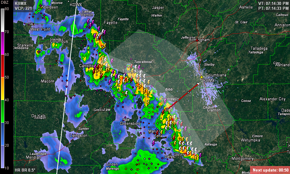
The line of storms over Central Alabama continues pushing north and northeast tonight. This graphic shows the expected progress of the line over the next 90 minutes.
Click image to enlarge
None of them are severe at this time, but they do contain huge amounts of deadly lightning, torrential rains and strong, gusty winds.
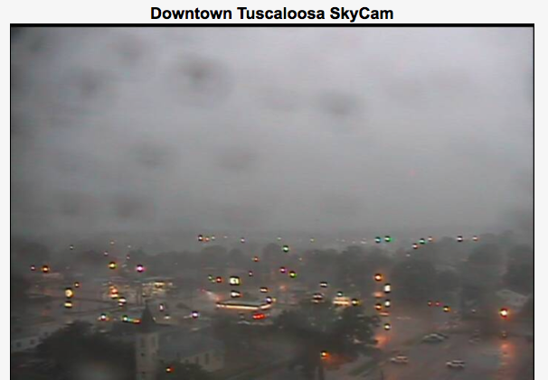
Winds gusted to 50 mph at our Tuscaloosa Skycam.
A 36 mph wind gust was recorded at the Tuscaloosa Airport:
KTCL 290031Z 19014G25KT 3/4SM VCTS +RA BR BKN027 OVC035 23/22 A3017 RMK AO2 PK WND 18031/0005 LTG DSNT W AND NW TSB2359RAB01 P0071
The airmass is slowly stabilizing, but there is still 1500-2000 joules of CAPE ahead of the storms, so this may allow them to reach Birmingham by 930, and southwestern sections around Bessemer by 845.
Category: Alabama's Weather, Severe Weather
About the Author (Author Profile)
Bill Murray is the President of The Weather Factory. He is the site's official weather historian and a weekend forecaster. He also anchors the site's severe weather coverage. Bill Murray is the proud holder of National Weather Association Digital Seal #0001 @wxhistorianSubscribe
If you enjoyed this article, subscribe to receive more just like it.


