

The New Potential Storm Surge Flooding Map
It is time to start learning about the new NWS Experimental Potential Storm Surge Flooding Map. The first ones were issued last evening by the National Hurricane Center for Arthur.
A few notes:
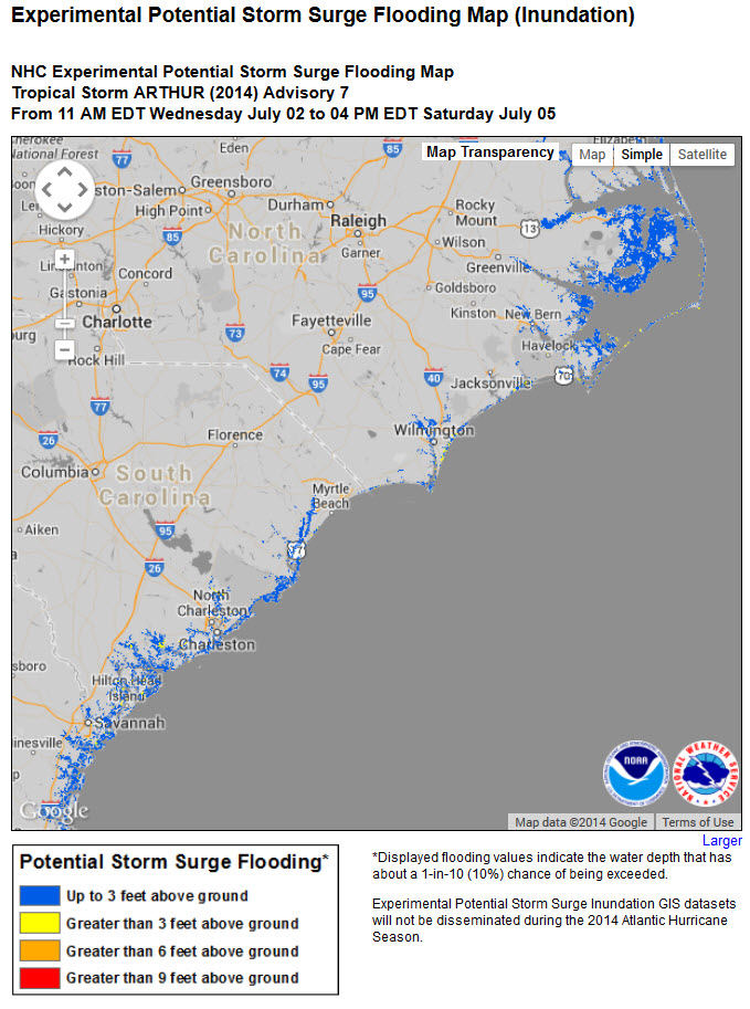
…The graphic shows a reasonable idea of worst-case scenario surge flooding from the storm. It is a map of the POTENTIAL flooding. It shows areas that COULD be affected by storm surge flooding, not necessarily how much water will be over each location in the shaded areas.
…There is a 10% exceedance factor, meaning that there is a 1 in 10 chance that the surge at any location could be higher.
…The flooding shows is only due to surge from the ocean, not rainfall flooding or flooding due to levee breaks or trapping.
…The product does take into account uncertainty in the track, size and intensity of the storm.
…Remember that weather conditions can change and so will this map.
…It is not a flood plain map. Storm surge can occur in areas that are NOT in a flood plain. Surge can occur miles inland.
…Evacuation zones may not correspond exactly with the surge flood map. People in evacuation aras should heed the advice of local emergency managers always.
…Remember that storm surge can occur well below and even after the center of the storm passes. In Ike on the Bolivar Peninsula, storm surge cut off evacuation routes nearly 36 hours before the arrival of the center.
…The product will be issued when hurricane or tropical storm watches are issued for any part of the Gulf or East Coasts of the United States.
Here is the current map from Advisory #7 at 10 a.m. this morning:
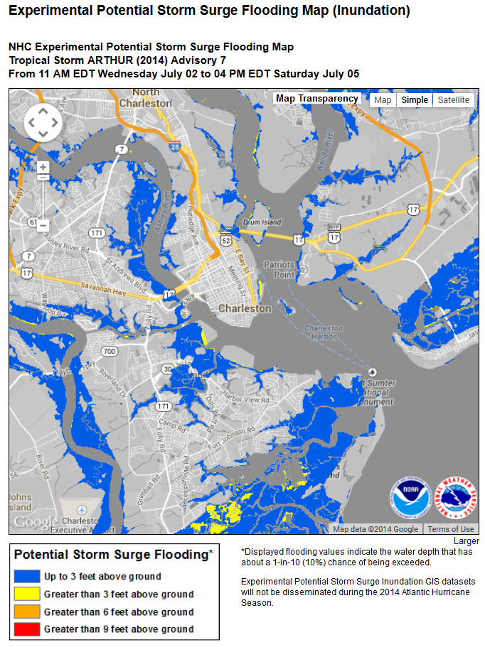
Zooming in on the Charleston SC area, a place that is very vulnerable to water inundation. The yellow shading indicates locations that could receive over 3 feet of flooding above ground, but less than 6 feet. The “above ground” indication is important since it takes into account land elevation. Keep in mind the 10% chance it could be
Take time to familiarize yourself with the product if you have interests along the Gulf of East Coast so that you will be ready to use it when a hurricane or tropical storm threatens.
Here is a short video on the product from the National Hurricane Center:
Category: Tropical
About the Author (Author Profile)
Bill Murray is the President of The Weather Factory. He is the site's official weather historian and a weekend forecaster. He also anchors the site's severe weather coverage. Bill Murray is the proud holder of National Weather Association Digital Seal #0001 @wxhistorianSubscribe
If you enjoyed this article, subscribe to receive more just like it.


