

Showers More Widespread Tomorrow
An all new edition of the ABC 33/40 Weather Xtreme video is available in the player on the right sidebar of the blog. You can subscribe to the Weather Xtreme video on iTunes by clicking here.
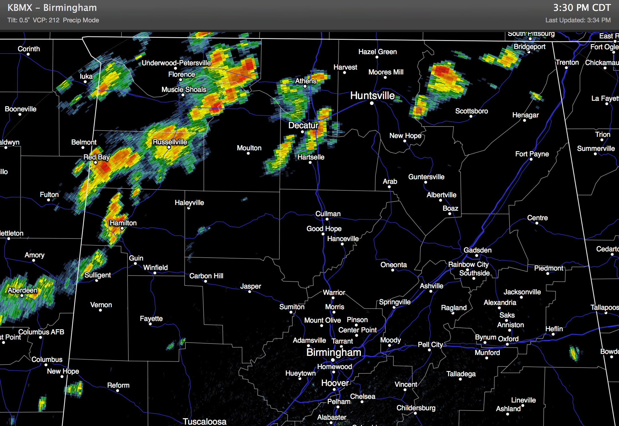
RADAR CHECK: Scattered showers and strong thunderstorms are mainly over the northern third of Alabama at mid-afternoon… most of the storms are north of U.S. 278, and are moving east. The southern two-thirds of the state is generally rain-free with temperatures in the 89-92 degree range.
TOMORROW/THURSDAY: Tomorrow looks like a relatively wet day, with occasional showers and thunderstorms. Showers could very well begin around daybreak across North/Central Alabama… it won’t rain all day long, but it could rain at any hour of the day, and a strong storm is possible. We won’t get past the low to mid 80s due to clouds and showers.
The coverage of showers on Thursday will begin to decrease, but there still should be a pretty decent risk of some rain from I-20 (Tuscaloosa to Birmingham to Anniston) south… showers over the northern third of the state will be fewer in number and pretty widely spaced as drier drops south from Tennessee.
FRIDAY AND THE WEEKEND: The trend will be toward hotter and drier weather across Alabama as the surface front loses it’s identity, and an upper ridge builds over the region. Look for mostly sunny, hot, hazy days with highs in the low 90s… a few mid 90s are possible in spots, especially over West Alabama. A few isolated afternoon showers can’t be ruled out over the weekend, but many most communities should be dry.
Then, early next week, there is a decent chance showers and storms will increase again as the ridge aloft weakens, and another surface boundary drops in from the north. See the Weather Xtreme video for the maps, graphics, and details.
AT THE BEACH: We project about 7 to 9 hours of sunshine each day through the weekend with just a few widely scattered storms from Panama City over to Gulf Shores. Highs on the coast will be in the upper 80s, and the sea water temperature this afternoon at the Dauphin Island Sea Lab is 84 degrees.
TROPICS: Dry air covers much of the Atlantic basin, and tropical storm formation is not expected through the week. And, over in the western Pacific, Typhoon Neoguri has weakened with sustained winds down to about 105 mph. Flash flooding is the primary through over southern Japan in coming days.
WEATHER BRAINS: Don’t forget you can listen to our weekly 90 minute netcast anytime on the web, or on iTunes. This is the show all about weather featuring many familiar voices, including our meteorologists here at ABC 33/40.
CONNECT: You can find me on all of the major social networks…
Facebook
Twitter
Google Plus
Instagram
I enjoyed seeing the senior adults today at First Baptist Church in Guin… look for the next Weather Xtreme video here by 7:00 a.m. tomorrow…
Category: Alabama's Weather
About the Author (Author Profile)
James Spann is one of the most recognized and trusted television meteorologists in the industry. He holds the AMS CCM designation and television seals from the AMS and NWA. He is a past winner of the Broadcast Meteorologist of the Year from both professional organizations.Subscribe
If you enjoyed this article, subscribe to receive more just like it.


