

Storms Starting to Fire
Click image to enlarge.
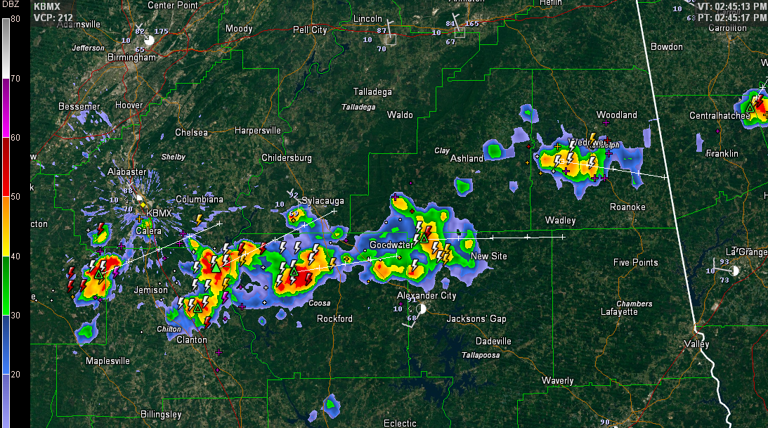
Clouds have held tough across much of the northern half of Alabama this morning in the wake of overnight storms that weakened as they pulled into the state.
There has been enough clearing for temperatures to heat into the middle and upper 80s in some spots and this has lent enough energy to the recipe to trigger a developing line of storms from Bibb across northern Chilton, Coosa, Tallapoosa and Chambers Counties. The storm northwest of Rockford is the strongest right now and has triggered a significant weather alert for parts of Coosa County. It will move east northeastward in the direction of Goodwater.
Additional storms will fire through the afternoon and last well into the night as a cool front sinks down from the north.
An isolated storm could become severe this afternoon with damaging winds, but the threat is small.
Category: Alabama's Weather, Severe Weather
About the Author (Author Profile)
Bill Murray is the President of The Weather Factory. He is the site's official weather historian and a weekend forecaster. He also anchors the site's severe weather coverage. Bill Murray is the proud holder of National Weather Association Digital Seal #0001 @wxhistorianSubscribe
If you enjoyed this article, subscribe to receive more just like it.


