

Scattered Storms Still Possible Today
An all new edition of the ABC 33/40 Weather Xtreme video is available in the player on the right sidebar of the blog. You can subscribe to the Weather Xtreme video on iTunes by clicking here.
WEDNESDAY’S RAIN: While a good part of North and Central Alabama saw beneficial rain yesterday, it was frustrating for many that live in the larger cities of Birmingham, Tuscaloosa, Anniston, and Gadsden as they were short changed on the rain. Some rain totals from yesterday included…
Muscle Shoals 2.38″
Jemison (Chilton County) 1.54″
Courtland 1.44″
Huntsville 1.01″
Fayette 0.65″
THE DAY AHEAD: We have a few widely scattered showers and storms on radar at daybreak…
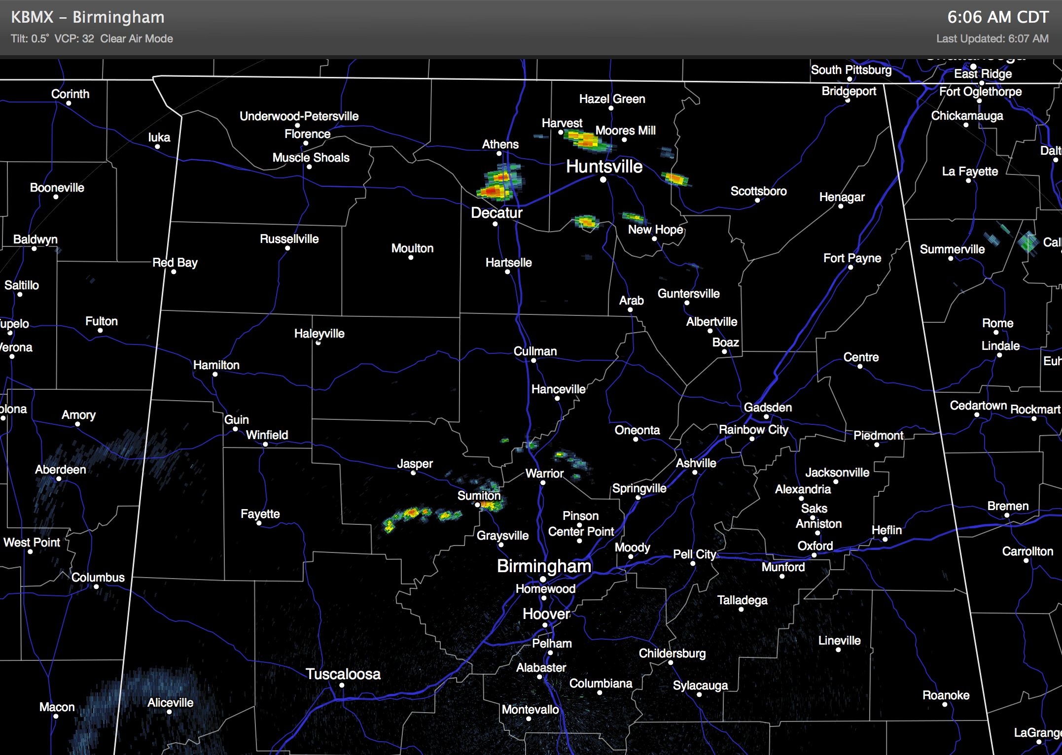
These will continue through the day in random places… otherwise we expect a mix of sun and clouds with a high generally in the upper 80s.
TOMORROW AND THE WEEKEND: The surface front north of the state will wash out, and as an upper high builds into the region, we project hotter and drier weather for Alabama. Highs will rise into the low 90s, maybe even mid 90s in a few spots, with a good supply of sunshine all three days. The chance of rain is not zero, but any afternoon showers and storms will be widely spaced.
NEXT WEEK: An interesting upper air pattern is setting up next week as the summer version of the “polar vortex” settles down into the Great Lakes… this should drive a summer cold front into Alabama Tuesday night or early Wednesday. Ahead of the front, there should be a marked increase in the number of showers and thunderstorms Tuesday. Then, sure seems like we have a good chance of another dry continental airmass moving into our state Wednesday and Thursday with lower humidity and cooler nights.
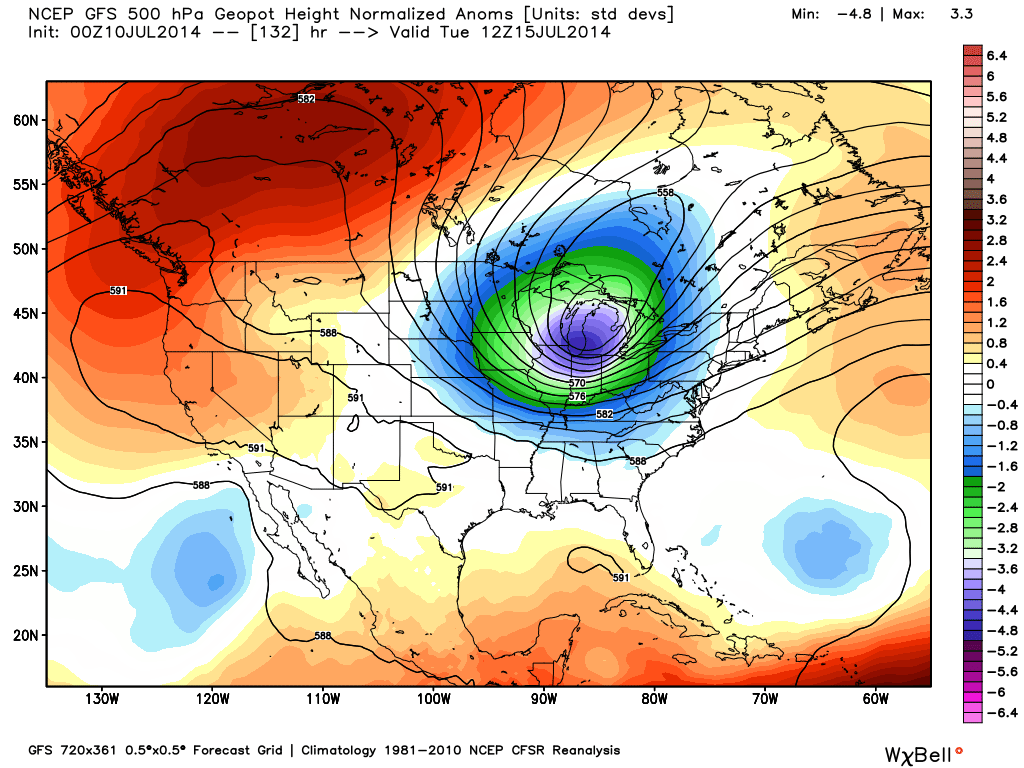
This could be an airmass much like the one we enjoyed around the Fourth of July when record lows were observed… would not be shocked to see lows in the 50s by Thursday morning (July 17). See the Weather Xtreme video for the maps, details, and graphics.
GULF COAST WEATHER: Showers and storms will be a little more active on the coast today between Panama City and Gulf Shores, but there will still be some good intervals of sunshine. Then, for tomorrow and the weekend, about 7 to 9 hours of sunshine each day with only isolated storms. Highs will remain in the upper 80s along the immediate coast, and the sea water temperature this morning at the Dauphin Island Sea Lab is 82 degrees.
TROPICS: Dry air continues to cover much of the Atlantic basin, and tropical storm formation is not expected anytime soon.
WEATHER BRAINS: Don’t forget you can listen to our weekly 90 minute netcast anytime on the web, or on iTunes. This is the show all about weather featuring many familiar voices, including our meteorologists here at ABC 33/40.
CONNECT: You can find me on all of the major social networks…
Facebook
Twitter
Google Plus
Instagram
Look for the next Weather Xtreme video here by 4:00 this afternoon…. enjoy the day….
Category: Alabama's Weather
About the Author (Author Profile)
James Spann is one of the most recognized and trusted television meteorologists in the industry. He holds the AMS CCM designation and television seals from the AMS and NWA. He is a past winner of the Broadcast Meteorologist of the Year from both professional organizations.Subscribe
If you enjoyed this article, subscribe to receive more just like it.


