

Afternoon Storms
Showers and storms have slowly grown across Central Alabama this afternoon as temperatures warmed into the 90s.
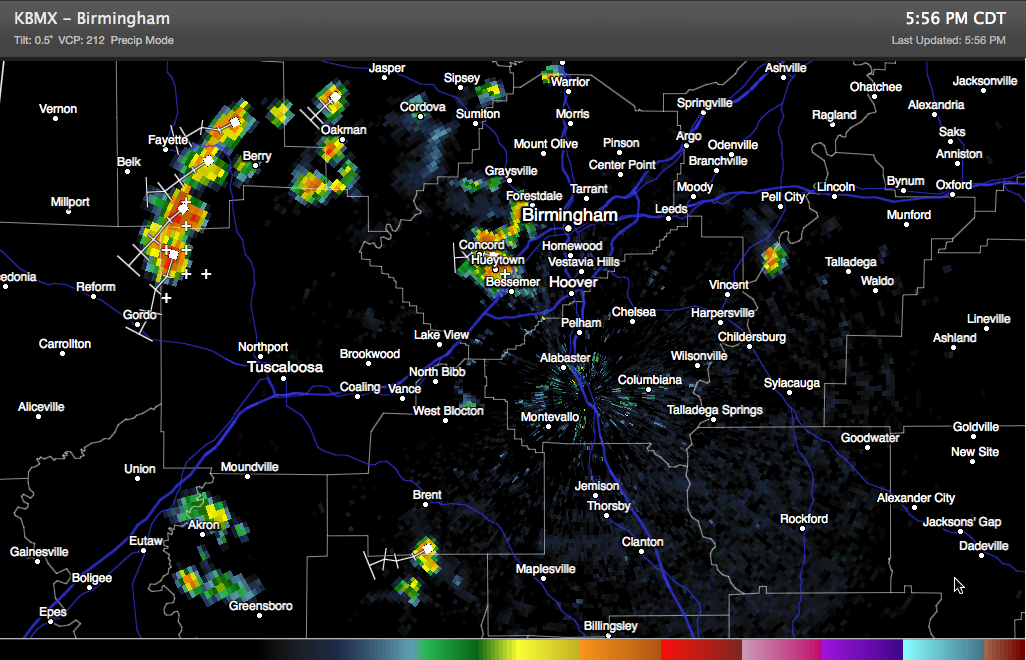
Most of them are west of I-65, with the heaviest concentration over Fayette, northwestern Tuscaloosa and Walker Counties. Another decent one is over western Jefferson County over the Hueytown/Pleasant Grove area. To the south there are others over Hale, Bibb and Perry County.
The lone exception is straddling the St. Clair/Talladega County County south of Pell City.
Everything is moving southwest and south.
If you find yourself under one of these storms, expect heavy rain, lightning and gusty winds.
Category: Alabama's Weather
About the Author (Author Profile)
Bill Murray is the President of The Weather Factory. He is the site's official weather historian and a weekend forecaster. He also anchors the site's severe weather coverage. Bill Murray is the proud holder of National Weather Association Digital Seal #0001 @wxhistorianSubscribe
If you enjoyed this article, subscribe to receive more just like it.


