

Storms Will Build in the I-59 Corridor
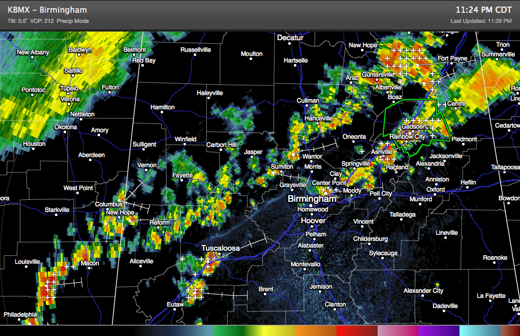
Showers pushing southeast across West Central and North Central Alabama tonight have started to weaken, pushing a distinct outflow boundary southeastward toward the I-5 corridor.
Click image to enlarge.
Showers and storms scattered along I-59 from Tuscaloosa to Birmingham to Gadsden will grow and intensify.
A storm in the Tuscaloosa area is already producing heavy rain and lightning.
Already, persistent heavy rains have been occurring in the Etowah and eastern St. Clair County areas into Cherokee County. A flash flood warning is in effect for parts of Etowah County.
Be alert for heavy rains, lightning and gusty winds over the next few hours. The storms are not severe, but we can’t rule out an isolated severe report or warning overnight.
Category: Alabama's Weather, Severe Weather
About the Author (Author Profile)
Bill Murray is the President of The Weather Factory. He is the site's official weather historian and a weekend forecaster. He also anchors the site's severe weather coverage. Bill Murray is the proud holder of National Weather Association Digital Seal #0001 @wxhistorianSubscribe
If you enjoyed this article, subscribe to receive more just like it.


