

Rare Mid-July Cold Front Getting Closer
An all new edition of the ABC 33/40 Weather Xtreme video is available in the player on the right sidebar of the blog. You can subscribe to the Weather Xtreme video on iTunes by clicking here.
ON THE MAPS: The cold front is near Memphis, and moving in our direction at daybreak…
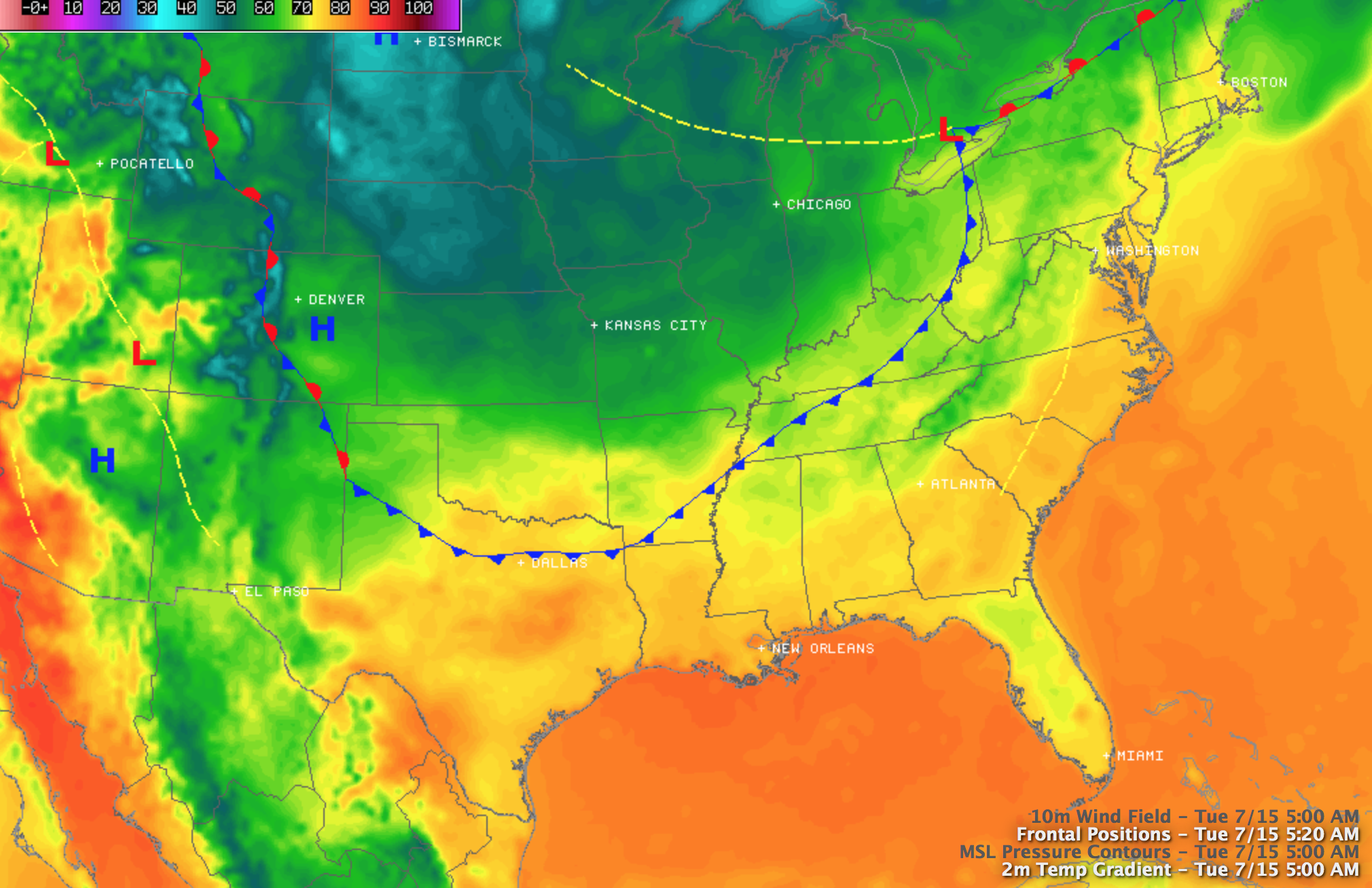
Behind the front, Kansas City has reported a record low of 54 degrees… and in North Dakota the community of Hettinger reported a chilly 39 degrees at 6:00 a.m. CT. And, yes, this is the middle of July.
Here in Alabama, we will maintain the chance of showers and storms today, but it won’t rain all day, and the rain distribution won’t be very even. The sky will be mostly cloudy with a high in the mid 80s… the 90s are gone for a while. The sky becomes clear tonight as dry air takes over.
TOMORROW/THURSDAY: Delightful weather, with mostly sunny days, low humidity, and cooler nights. For places like Birmingham, Tuscaloosa, and Anniston, the early morning lows will be close to 60 degrees, but to the north 50s are likely over the northern third of Alabama both mornings. Birmingham’s record low of 62 degrees for July 17 (set in 1965) of 62 degrees is very much in danger.
FRIDAY AND THE WEEKEND: Moisture surges northward late in the week, and showers and storms are possible by Friday afternoon. Weather for the weekend will be wet at times with occasional showers and thunderstorms Saturday and Sunday. The sky will be generally cloudy with only a limited amount of sun, and highs will be in the mid 80s.
The chance of showers and storms will continue early next week as the big heat bubble will be well to the west of here, over the western U.S. See the Weather Xtreme video for the maps, graphics, and details.
GULF COAST WEATHER: A few showers and storms are likely today from Panama City over to Gulf Shores, but there will be some sun at times. Then, the weather looks mostly dry tomorrow and Thursday with only isolated showers or storms. Then, for Friday and the weekend, expect about 5 to 7 hours of sunshine each day with scattered showers and thunderstorms. Highs on the immediate coast will be in the upper 80s, and the sea water temperature early this morning at the Dauphin Island Sea Lab is 83 degrees.
TROPICS: The Atlantic basin remains very quiet, and tropical storm formation is not expected through the weekend.
WEATHER BRAINS: Don’t forget you can listen to our weekly 90 minute netcast anytime on the web, or on iTunes. This is the show all about weather featuring many familiar voices, including our meteorologists here at ABC 33/40. Scroll down for the show notes on the new episode we recorded last night.
CONNECT: You can find me on all of the major social networks…
Facebook
Twitter
Google Plus
Instagram
Look for the next Weather Xtreme video here by 4:00 this afternoon… enjoy the day…
Category: Alabama's Weather
About the Author (Author Profile)
James Spann is one of the most recognized and trusted television meteorologists in the industry. He holds the AMS CCM designation and television seals from the AMS and NWA. He is a past winner of the Broadcast Meteorologist of the Year from both professional organizations.Subscribe
If you enjoyed this article, subscribe to receive more just like it.


