

Warm, Moist Air Stays In Place
An all new edition of the ABC 33/40 Weather Xtreme video is available in the player on the right sidebar of the blog. You can subscribe to the Weather Xtreme video on iTunes by clicking here.
RADAR CHECK: Scattered showers and storms continue, mostly over the eastern half of Alabama at mid-afternoon. There is very little movement… just a drift toward the west/northwest, so some places have seen heavy rain. Temperatures are mostly in the 80s… this will be the seventh consecutive day with a high below 90 degrees in Birmingham. Quite remarkable for mid-July.
An upper low is over East Alabama, and is expected to drift southwest, toward Mobile tomorrow. This should mean a rather unsettled day tomorrow for the state, with a mostly cloudy sky and scattered to numerous showers and thunderstorms. Once again the high should be in the 80s due to clouds and showers.
WEDNESDAY THROUGH FRIDAY: The upper low will weaken and dissipate, so Wednesday looks like a typical summer day with a partly sunny and the risk of scattered, mostly afternoon and evening showers and thunderstorms. Then, an approaching front should bring an increase in the number of showers and storms to the northern half of the state Thursday afternoon into Thursday night.
The latest GFS (12Z run) brings drier air down into North Alabama Friday, suggesting the highest risk of showers and storms will come over South Alabama.
THE ALABAMA WEEKEND: For now Saturday looks relatively rain-free with only isolated showers, but a disturbance in the northwest flow aloft across the Deep South could bring an increase in the number of showers and thunderstorms Saturday night or Sunday. Highs this weekend should be close to 90 degrees.
LONG RANGE: Global models are showing another deep, long wave upper trough over the eastern U.S. in 9-12 days; this could bring another “cool” and refreshing airmass down into the southern states during a time when summer heat is usually peaking. Let’s hope this verifies.
GULF COAST WEATHER: About 4-6 hours of sun tomorrow along the coast from Panama City to Gulf Shores with scattered showers and thunderstorms. Then, we expect increasing amounts of sun and fewer showers Thursday and Friday. Highs will remain in the mid to upper 80s along the immediate coast, and the NWS Mobile has been warning of dangerous rip tides in coastal waters. Sea water temperatures are mostly in the low to mid 80s.
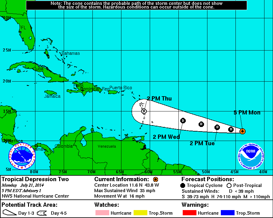
NEW TROPICAL DEPRESSION: The disturbance in the Atlantic about halfway between the coast of Africa and the Windward Islands has become the second tropical depression of the season in the Atlantic basin. The good news is that this is not expected to reach tropical storm strength, and should dissipate before reaching the islands due to harsh environmental conditions.
The rest of the Atlantic basin is quiet.
WEATHER BRAINS: Don’t forget you can listen to our weekly 90 minute netcast anytime on the web, or on iTunes. This is the show all about weather featuring many familiar voices, including our meteorologists here at ABC 33/40. Oklahoma City TV weather legend Gary England will join us this week… the show will be produced tonight at 8:30 CT. You can watch it on “James Spann 24/7” on cable systems around the state, or on the web here.
CONNECT: You can find me on all of the major social networks…
Facebook
Twitter
Google Plus
Instagram
Look for the next Weather Xtreme video here by 7:00 a.m. tomorrow….
Category: Alabama's Weather
About the Author (Author Profile)
James Spann is one of the most recognized and trusted television meteorologists in the industry. He holds the AMS CCM designation and television seals from the AMS and NWA. He is a past winner of the Broadcast Meteorologist of the Year from both professional organizations.Subscribe
If you enjoyed this article, subscribe to receive more just like it.


