

Scattered Showers/Storms Again Today
An all new edition of the ABC 33/40 Weather Xtreme video is available in the player on the right sidebar of the blog. You can subscribe to the Weather Xtreme video on iTunes by clicking here.
RADAR CHECK: All is quiet across the great state of Alabama this morning; temperatures are mostly in the low 70s and there is no rain on radar at daybreak. A blanket of moist air continues to cover Alabama, and on the maps we have a weak upper low near New Orleans. This means the weather won’t change much today; scattered showers and storms will fire up later with a high in the upper 80s in most places.
Birmingham has gone eight consecutive days with a high below 90 degrees, and that streak will most likely continue today.
TOMORROW: We project a higher coverage of showers and thunderstorms tomorrow, especially during the afternoon hours, as a surface front approaches from the north. A few strong storms are possible, but organized severe weather is not likely. The sky will be generally cloudy with a high between 86 and 89 degrees.
DRIER FRIDAY AND SATURDAY: Drier air will move down into the northern half of Alabama on these two days, and the weather looks mostly rain-free with lower humidity levels and a decent amount of sunshine. The high will be around 90 degrees, and scattered storms should be confined to the southern counties of the state.
SUNDAY/MONDAY: Moist air returns Sunday with a chance of showers and thunderstorms, and another surface front will move down this way Sunday night into Monday. The 00Z run of the GFS is faster with the front, and brings down drier air into North Alabama Monday morning. For now we will keep a chance of showers/storms in the forecast Monday, but if the faster trend continues we will trend toward a drier forecast.
NEXT WEEK: Another high amplitude upper pattern will bring another refreshing airmass into Alabama during the mid-week period. Not sure this air will be quiet as cool as the ones we enjoyed earlier this month, but no doubt the humidity will be lower, and the lows Wednesday morning should be in the low 60s, with 50s for the cooler pockets across North Alabama. The record low for Birmingham for July 30 is 61 degrees set in 1994… we might give that a run for the money early Wednesday. See the Weather Xtreme video for the maps, graphics, and details.
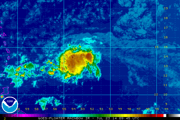
TROPICS: Tropical depression two is hanging in there like a rusty fish hook, despite very dry air surrounding the system and moderate wind shear. This will pass through the Leeward Islands late tonight, and should dissipate, or become a remnant low over the eastern Caribbean late tomorrow. The rest of the Atlantic basin is quiet.
GULF COAST WEATHER: The weather is looking good from Panama City to Gulf Shores through the weekend; about 7 to 9 hours of sunshine each day with only widely scattered storms around. Highs on the immediate coast will be in the upper 80s, and the sea water temperature at the Dauphin Island Sea Lab this morning is 83 degrees.
WEATHER BRAINS: Don’t forget you can listen to our weekly 90 minute netcast anytime on the web, or on iTunes. This is the show all about weather featuring many familiar voices, including our meteorologists here at ABC 33/40.
CONNECT: You can find me on all of the major social networks…
Facebook
Twitter
Google Plus
Instagram
I will be doing a weather program this morning at the public library in Alexander City… look for the next Weather Xtreme video here by 4:00 this afternoon. Enjoy the day!
Category: Alabama's Weather
About the Author (Author Profile)
James Spann is one of the most recognized and trusted television meteorologists in the industry. He holds the AMS CCM designation and television seals from the AMS and NWA. He is a past winner of the Broadcast Meteorologist of the Year from both professional organizations.Subscribe
If you enjoyed this article, subscribe to receive more just like it.


