

Warmest Day of the Year?
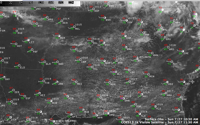
An impressive cumulus field was blossoming across Central Alabama on this last Sunday in July. The healthy fair weather clouds have multiplied in the deeper moisture that is over the state today. Morning dewpoint levels are in the lower and middle 70s, some 6-7 degrees higher than those of the same time yesterday.

The fair skies are the result of sprawling upper level high pressure over the southern tier of states, stretching from Utah to Alabama. This high should again put the kibosh on showers this afternoon.
It will also allow the mercury to warm well into the middle and upper 90s across the area. It was already 91F at Tuscaloosa at 11 a.m. and 88F at Birmingham. The Birmingham reading is some three degrees ahead of the temperature at the same time yesterday.
LATE NOTE: It had reached 91F at the Birmingham Airport at noon as temperatures continue to soar.
This may allow today to be the warmest day of the year in the Magic City. The 95F yesterday is currently tie with two other July days for the warmest day of 2014.
HEAT ADVISORY: With the combination of highs in the middle and upper 90s and high humidity, the National Weather Service has issued a Heat Advisory for West Central and South Central Alabama. Places like Vernon, Tuscaloosa, Demopolis, Selma, Montgomery and Troy are in the Heat Advisory for heat index values pushing 105F degrees today. Elsewhere, in places like Birmingham, Hamilton, Cullman, Gadsden, Anniston, Alex City and Auburn, heat indices today will top out above 100F, but remain just below Advisory criteria.
A line of showers and storms storms is expected to develop by mid-afternoon near the Ohio River and push southeastward this afternoon and evening. It will arrive at the Northwest Corner of Alabama around 9 p.m. and die out as it progresses. It should be completely gone by the time it gets to Birmingham and I-20.
This activity is ahead of a cold front that has passed St. Louis this afternoon. It will arrive in Northwest Alabama afternoon midnight and clear the Birmingham area during the late morning.
Much of North Central Alabama may miss out completely on the rain and storm, with the best chances tomorrow coming south of Clanton. We note that the SPC does have much of southern Alabama in a slight risk severe weather outlook, their standard forecast.
Cooler and drier air will follow on the heels of the front, much like last week. Look for several 50s by Wednesday morning, which is record country for July 30th in Alabama
Category: Alabama's Weather
About the Author (Author Profile)
Bill Murray is the President of The Weather Factory. He is the site's official weather historian and a weekend forecaster. He also anchors the site's severe weather coverage. Bill Murray is the proud holder of National Weather Association Digital Seal #0001 @wxhistorianSubscribe
If you enjoyed this article, subscribe to receive more just like it.


