

A Few Showers This Afternoon, A Few Showers Tonight
Showers formed late this morning over West Central Alabama, extending back into Mississippi along the leading edge of a southwesterly flow aloft ahead of an upper level disturbance near St. Louis.
The showers extend from southern Tuscaloosa County back through Greene and Hale and into Sumter Counties. The activity extends eastward across South Central Alabama from Dallas County eastward through northern Montgomery and Elmore Counties to Clay, Randolph and Lee Counties. The activity is widely scattered at this time.

The graphic shows heat index values at this hour. They are not quite to the advisory criteria of 105F, but they are close in spots. Note that the 104F at Jasper is a suspect value.
Temperatures are in the middle 90s, ranging from 96F at Anniston to 95F at Calera and Birmingham. The temperature at Tuscaloosa peaked at 95F before nearby showers cooled the air by 10 degrees.
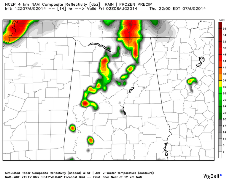
The main lobe of vorticity is pushing through western Mississippi and this hour. It will bring a round of scattered showers and storms to western and northwestern Alabama this evening. Here is the 4km NAM Simulated Radar Reflectivity for 9 p.m. tonight.
Category: Alabama's Weather
About the Author (Author Profile)
Bill Murray is the President of The Weather Factory. He is the site's official weather historian and a weekend forecaster. He also anchors the site's severe weather coverage. Bill Murray is the proud holder of National Weather Association Digital Seal #0001 @wxhistorianSubscribe
If you enjoyed this article, subscribe to receive more just like it.


