

Higher Rain Chances Ahead
An all new edition of the ABC 33/40 Weather Xtreme video is available in the player on the right sidebar of the blog. You can subscribe to the Weather Xtreme video on iTunes by clicking here.
BIG STORMS FOR SOME YESTERDAY: A number of Alabama communities saw big summer storms late yesterday, on what will probably be the hottest day of the summer for our state. A flash flood warning was needed for parts of Marshall County, and there was extensive tree and power line damage north of Gadsden atop Lookout Mountain, and on Sand Mountain near Boaz and Albertville due to wet microbursts.
THE DAYS AHEAD: A wavy, zonal flow will bring a series of waves into Alabama through early next week, meaning scattered to numerous showers and thunderstorms on a daily basis. The sky will be occasionally cloudy, and while the best chance of showers and storms will come during the afternoon and evening hours, we can’t totally rule out a late night or morning shower. Highs will drop into the 88-92 degree range through Sunday, considerably lower than the 99 degree high we saw in Birmingham yesterday.
For those planning outdoor events this weekend, due to the scattered nature of summer storms there is no way to tell you the exact start/stop times for rain at any given location, just be prepared for a shower or storm at any time. And, like yesterday, the storms will be pretty strong with potential for localized flooding and lots of lightning. But, the sun will be out at times, and the rain won’t be continuous.
We all know rain distribution in summer is not even, but on an average basis many Alabama communities will see two inches of rain between now and Wednesday.
LATE NEXT WEEK: The GFS is hinting that another summer “cold front” will move down into South Alabama, with potential for lower humidity and cooler nights for North Alabama by Thursday and Friday. We will have to wait and see on that idea. See the Weather Xtreme video for the maps, graphics, and more details.
GULF COAST WEATHER: About 6 to 8 hours of sunshine each day through early next week along the Gulf Coast from Panama City west to Gulf Shores with the usual risk of scattered thunderstorms. Highs will remain in the upper 80s, and the sea water temperature early this morning at the Dauphin Island Sea Lab is 86 degrees.
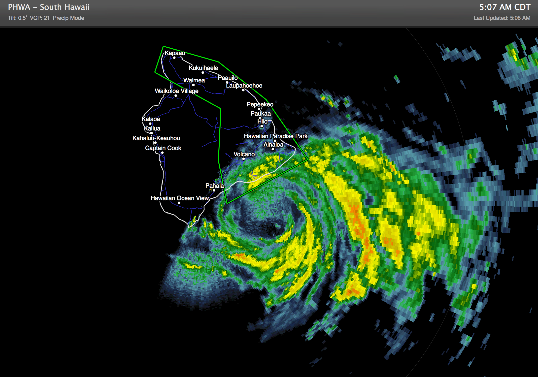
TROPICS: The Atlantic basin remains very quiet, but the Pacific is rocking and rolling. Iselle continues to weaken, and moved into the Big Island of Hawaii this morning as a tropical storm. Flooding remains the primary threat with this system…
And, to the east, Hurricane Julio will pass north of the Hawaiian Islands this weekend as it weakens. Again, see all the maps on the Weather Xtreme video.
WEATHER BRAINS: Don’t forget you can listen to our weekly 90 minute netcast anytime on the web, or on iTunes. This is the show all about weather featuring many familiar voices, including our meteorologists here at ABC 33/40.
CONNECT: You can find me on all of the major social networks…
Facebook
Twitter
Google Plus
Instagram
Look for the next Weather Xtreme video here by 4:00 this afternoon…. enjoy the day!
Category: Alabama's Weather
About the Author (Author Profile)
James Spann is one of the most recognized and trusted television meteorologists in the industry. He holds the AMS CCM designation and television seals from the AMS and NWA. He is a past winner of the Broadcast Meteorologist of the Year from both professional organizations.Subscribe
If you enjoyed this article, subscribe to receive more just like it.


