

Showers/Storms Likely Later Today
An all new edition of the ABC 33/40 Weather Xtreme video is available in the player on the right sidebar of the blog. You can subscribe to the Weather Xtreme video on iTunes by clicking here.
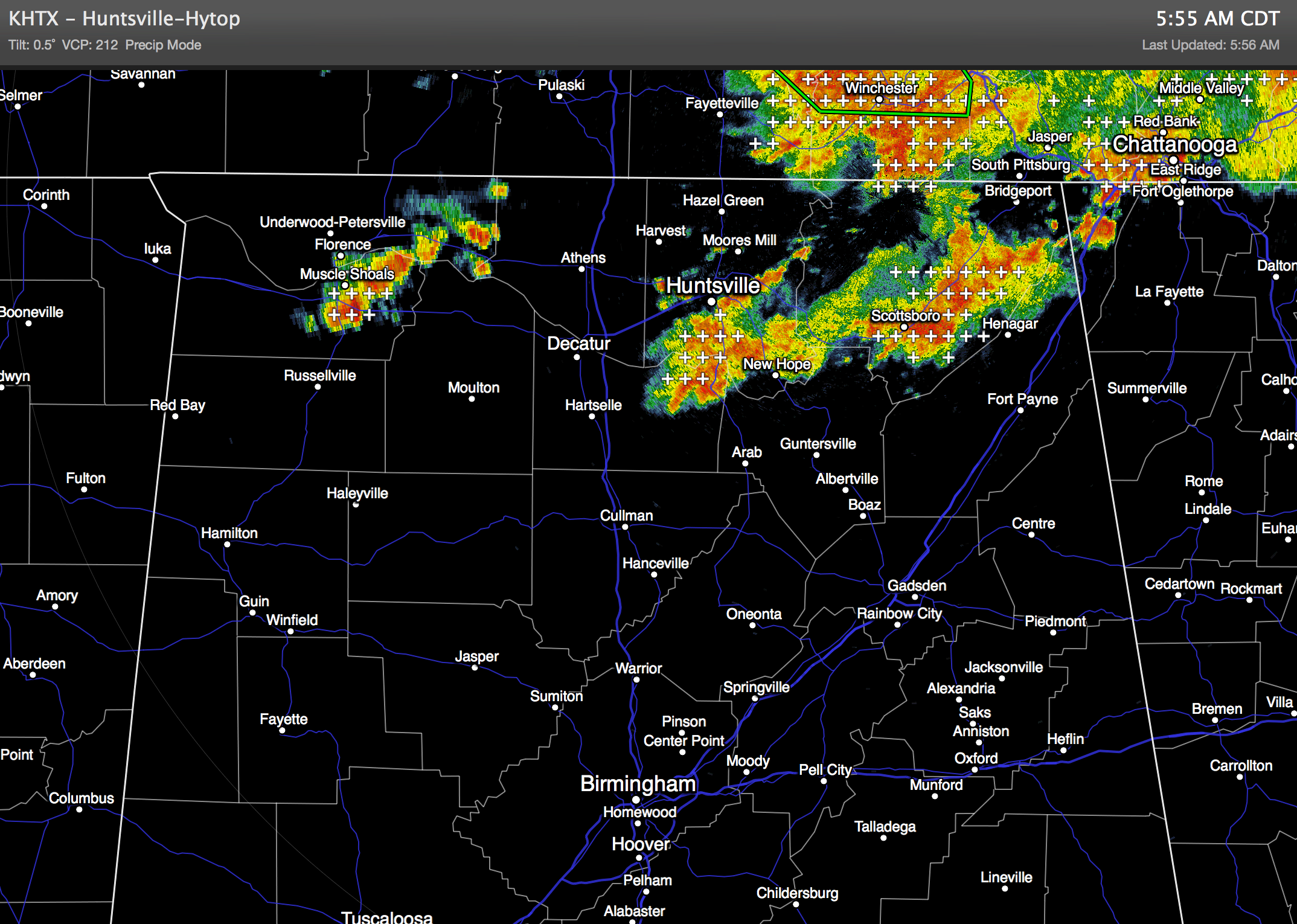
RADAR CHECK: Some heavy rain is falling this morning over the Tennessee Valley region of extreme North Alabama at daybreak; these showers and storms are moving east. No rain for the I-20/59 corridor to the south.
THE DAY AHEAD: Showers and storms will form over Central Alabama later today and early tonight… any one spot will have a 60-70 percent chance of getting wet. It won’t rain everywhere, but today will offer the highest coverage of storms this week.
Some of the storms will pack a punch; SPC has low end 5 percent severe weather possibilities in place for much of North/Central Alabama. Storms will produce heavy rain, lots of lightning, and a wet microburst can’t be ruled out in a few spots. Today’s high will be in the 87 to 90 degree range.
REST OF THE WEEK: Showers and storms will thin out tomorrow as an upper high begins to build across the region, and that big 5940 meter 500 mb ridge should mean dry and hot weather for the state Wednesday through Friday, with mostly sunny days and afternoon temperatures rising into the mid to upper 90s.
WEEKEND PREVIEW: The ridge weakens slightly, but the weather still looks mostly dry and hot Saturday and Sunday. Highs in the mid 90s… if we do see an afternoon storm, the better chance will come on Sunday. But, they will be widely scattered.
NEXT WEEK Temperatures will gradually trend downward, with a better chance of scattered showers and storms by mid-week. See the Weather Xtreme video for the maps, graphics, and details.
GULF COAST WEATHER: About 5 to 7 hours of sun today on the coast from Panama City west to Gulf Shores with scattered showers and thunderstorms. Then, mostly sunny days, fair nights, and only isolated storms tomorrow through the weekend. Highs will be in the 87 to 90 degree range on the immediate coast, and the sea water temperature early this morning at the Dauphin Island Sea Lab is 84 degrees.
TROPICS: A weak impulse is moving across the Central Atlantic, but dry air surrounds the system, and tropical storm formation is not expected over the next few days.
WEATHER BRAINS: Don’t forget you can listen to our weekly 90 minute netcast anytime on the web, or on iTunes. This is the show all about weather featuring many familiar voices, including our meteorologists here at ABC 33/40. We will produce this week’s show tonight at 8:30 CT… you can watch it on “James Spann 24/7” on cable systems around the state, or on the web here.
CONNECT: You can find me on all of the major social networks…
Facebook
Twitter
Google Plus
Instagram
Look for the next Weather Xtreme video here by 4:00 or so this afternoon… enjoy the day…
Category: Alabama's Weather
About the Author (Author Profile)
James Spann is one of the most recognized and trusted television meteorologists in the industry. He holds the AMS CCM designation and television seals from the AMS and NWA. He is a past winner of the Broadcast Meteorologist of the Year from both professional organizations.Subscribe
If you enjoyed this article, subscribe to receive more just like it.


