

Hot, Hazy Summer Days
An all new edition of the ABC 33/40 Weather Xtreme video is available in the player on the right sidebar of the blog. You can subscribe to the Weather Xtreme video on iTunes by clicking here.
AUGUST IN ALABAMA: An upper high building over the Deep South will set up the hottest five day stretch of the summer for our state; we are projecting highs in the mid to upper 90s today through the weekend. Hot hazy days, mostly fair nights.
As always, a thunderstorm is possible during the afternoon and evening hours in a hot pattern like this, but they will be widely spaced, and the actual chance of your lawn getting wet is in the 10-20 percent range each day.
HIGH SCHOOL FOOTBALL: The season kicks off for our state this week, with most games tomorrow night, and a few tonight. Both nights expect a kickoff temperature in the 87-90 degree range; the chance of a storm at any one specific stadium is about one in ten. Humidity levels will be high, and it sure won’t feel very comfortable. But then again, that is what you get when you play football in August in Alabama.
NEXT WEEK: The upper ridge weakens as a big trough approaches from the west, and heat levels will drop with a gradual increase in the number of scattered thunderstorms. Some chance a cold front pushes through late in the week with a reduction in humidity levels and cooler nights. See the Weather Xtreme video for the maps, graphics, and details.
GULF COAST WEATHER: Mostly sunny days, fair nights, and only isolated thunderstorms for the stretch from Panama City to Gulf Shores through the weekend. Highs will be in the 87-90 degree range on the immediate coast, with mid to upper 90s inland. The sea water temperature early this morning at the Dauphin Island Sea Lab is 86 degrees.
Way too early to forecast weather on the coast for the Labor Day weekend, but we see no evidence now in media range modeling of any tropical issues for the Gulf Coast through early September.
TROPICAL WEATHER: The wave approaching the Lesser Antilles seems to be developing a CDO (central dense overcast) early this morning, and a tropical depression could form in that region within 48 hours. Models continue to trend eastward, and now all tropical and global models suggest this will not be a problem for the Gulf of Mexico.
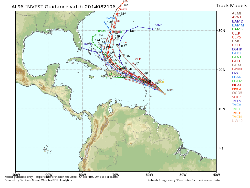
Still, there will be a good bit of uncertainty in this until a well defined center can develop. See the Weather Xtreme video for more details.
WEATHER BRAINS: Don’t forget you can listen to our weekly 90 minute netcast anytime on the web, or on iTunes. This is the show all about weather featuring many familiar voices, including our meteorologists here at ABC 33/40.
CONNECT: You can find me on all of the major social networks…
Facebook
Twitter
Google Plus
Instagram
Look for the next Weather Xtreme video here by 4:00 this afternoon… enjoy the day.
Category: Alabama's Weather
About the Author (Author Profile)
James Spann is one of the most recognized and trusted television meteorologists in the industry. He holds the AMS CCM designation and television seals from the AMS and NWA. He is a past winner of the Broadcast Meteorologist of the Year from both professional organizations.Subscribe
If you enjoyed this article, subscribe to receive more just like it.


