

Afternoon Radar Check
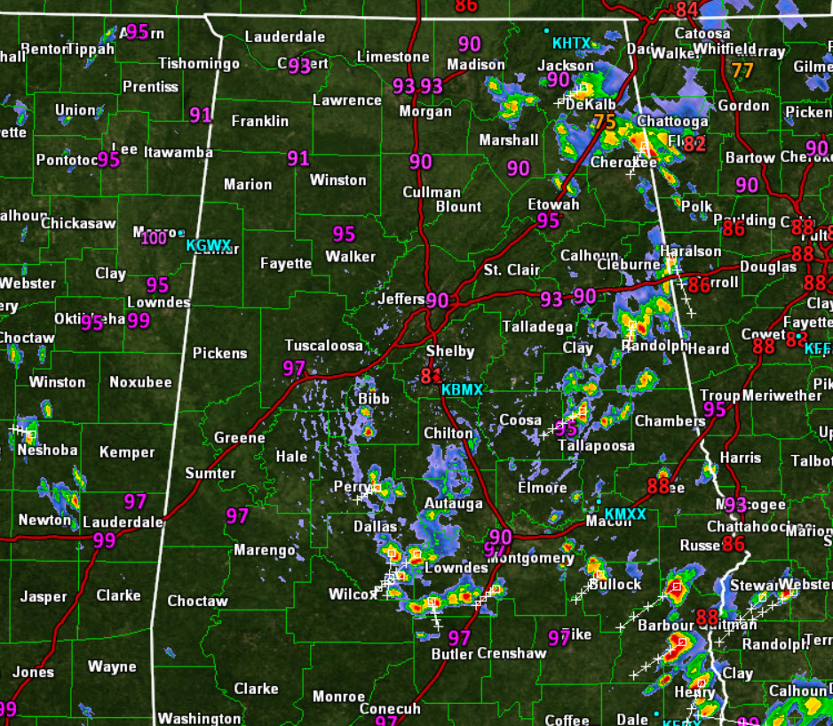
It continues to be very hot and humid across the state today. Unlike yesterday, where just a few storms developed, there are many more showers and storms this afteroon. The bulk of the activity is over eastern portions of the state, and this activity is drifting towards the south-southwest. The U.S. 431 Highway is be impacting up and down the eastern side of the state, as several areas of storms are producing very heavy rainfall and dangerous lightning. A few storms could be producing gusty winds and small hail as well.
There is another batch of activity from Bibb County down through Perry, Dallas, and Lowndes County. Once again, all activity is moving towards the south-southwest. The storms out there now, will persist through the afternoon and evening hours, before the begin to weaken after sunset. Where it has rained, temps have dropped into the 70s and 80s as seen in DeKalb and Shelby counties. Where the rain has not fallen, it is very hot as mid to upper 90s continue across many areas of the state.
Click image to enlarge.
Category: Alabama's Weather
About the Author (Author Profile)
Macon, Georgia Television Chief Meteorologist, Birmingham native, and long time Contributor on AlabamaWX. Stormchaser. I did not choose Weather, it chose Me. College Football Fanatic. @Ryan_StinnetSubscribe
If you enjoyed this article, subscribe to receive more just like it.


