

Cold Front Getting Closer
An all new edition of the ABC 33/40 Weather Xtreme video is available in the player on the right sidebar of the blog. You can subscribe to the Weather Xtreme video on iTunes by clicking here.
WARM AND HUMID THROUGH TOMORROW: We still have a rather tricky forecast for the weekend as a slow moving cold front will creep into Alabama late tomorrow and tomorrow night. Where it stops will determine the weather where you live, and that is a tough call. Let’s break it down one day at a time…
TODAY/TONIGHT: I think most of the day will be dry for North/Central Alabama, although a few isolated showers could pop up this afternoon. A band of showers and storms should creep into the Tennessee Valley of far North Alabama late in the day, and those will move slowly southward tonight. The NWS in Memphis has issued a flash flood watch for their county warning area, but we don’t expect any flooding issues, or severe weather problems here as the dynamic support will be lifting out. High resolution model data hints the band of showers and storms will reach Tuscaloosa, Birmingham, Anniston, and Gadsden in the 9 to 11 p.m. time frame if it holds together. The high today should be in the upper 80s for most communities.
TOMORROW: The front will be close to the Alabama/Tennessee border, so we stay in moist air. The day should feature a mix of sun and clouds, and we will mention scattered showers and thunderstorms. No “all day” rain, but a shower or storm is possible at just about any hour of the day, or tomorrow night. The high will be in the mid 80s, about average for mid-September in Alabama.
SATURDAY: This is the difficult part of the forecast. The front will drift down toward I-59 and stop, meaning a fairly sharp contrast between the dry air north of the front, and the humid air to the south. The day should begin with a mostly cloudy sky along with the chance of a little drizzle in spots… then the sun breaks out by mid to late morning. During the afternoon and evening hours, using data from the GFS and the high resolution NAM model, it looks like the best chance of showers will come south of I-59. Places like Anniston, Talladega, Sylacauga, Clanton, and Lineville could very well see a few showers Saturday afternoon. But, from Birmingham north and west, the afternoon should be dry with a partly sunny sky and slightly lower humidity levels. The high should be in the low to mid 80s.
SUNDAY: The front pretty much stays in the same place, so the northern half of the state should be generally dry, but South Alabama will have a continued risk of showers with a high in the mid 80s again.
FOOTBALL WEATHER: Again this week we have the risk of a passing shower or storm for high school games tonight and tomorrow night. The showers and and storms will be scattered, so it won’t rain everywhere, but a few stadiums could see some rain. Temperatures will be in the low to mid 80s at kickoff, falling into the 70s by the fourth quarter. The chance of any one stadium seeing rain is in the 30 percent range.
Alabama will host Southern Miss Saturday evening (5:00p kickoff) at Bryant-Denny Stadium; at this point it looks like the sky will be mostly fair with a kickoff temperature near 83 degrees, falling through the 70s during the second half.
UAB hosts Alabama A&M Saturday at Legion Field in Birmingham at 2:30p; the sky will be partly sunny with only a slight risk of a shower. The temperature will be around 86 degrees at kickoff, falling into the upper 70s by the final whistle.
NEXT WEEK: Seems to be a rather quiet week; the front will dissipate, and we might see a few widely scatterer showers or a day or two, but no widespread rain is expected, and highs should be in the low to mid 80s. See the Weather Xtreme video for the maps, graphics, and more details.
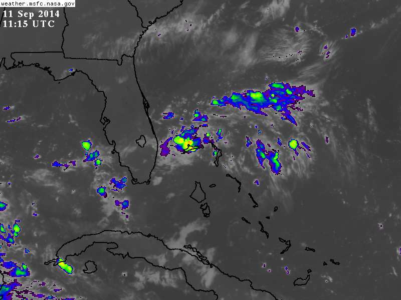
TROPICS: A disturbance in the eastern Atlantic could become a tropical storm over the weekend, but it will recurve harmlessly over the open Atlantic and is no threat to land. Another disturbance is over the northern Bahamas; most dynamic models push this westward across the Florida peninsula and into the Gulf of Mexico in coming days, but conditions are only marginal for development there. Still, we will keep an eye on it.
GULF COAST WEATHER: We still expect about 6 to 8 hours of sunshine each day through the weekend from Panama City west to Gulf Shores, with the daily risk of scattered showers and thunderstorms. Highs will be in the mid to upper 80s, with sea water temperatures mostly in the mid 80s.
WEATHER BRAINS: Don’t forget you can listen to our weekly 90 minute netcast anytime on the web, or on iTunes. This is the show all about weather featuring many familiar voices, including our meteorologists here at ABC 33/40.
CONNECT: You can find me on all of the major social networks…
Facebook
Twitter
Google Plus
Instagram
Look for the next Weather Xtreme video here by 4:00 this afternoon…. enjoy the day…
Category: Alabama's Weather
About the Author (Author Profile)
James Spann is one of the most recognized and trusted television meteorologists in the industry. He holds the AMS CCM designation and television seals from the AMS and NWA. He is a past winner of the Broadcast Meteorologist of the Year from both professional organizations.Subscribe
If you enjoyed this article, subscribe to receive more just like it.


