

Strong Storms over Jefferson, Shelby, St. Clair
UPDATE AT 2:50 PM
The NWS has added an Areal Flood Advisory for parts of Jefferson and St. Clair Counties as well. Communities include Pinson, Center Point, Trussville, Argo and Branchville. A wide area has received at least an inch of rain in a short time between the above communities.
ORIGINAL POST
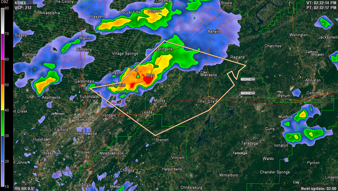
Strong thunderstorms are occurring at this time over northeastern Jefferson and western St. Clair Counties. They are centered in the Clay, Argo and CenterPoint areas.
The NWS has issued a Significant Weather Alert for the area inside the polygon on the above graphic.
They are moving southeast at 10 mph and will pass near Trussville, Branchville and Moody.
They contain dangerous lightning, wind gusts to over 40 mph and copious amounts of rain.
Be indoors as these dangerous storms approach.
Category: Alabama's Weather, Severe Weather
About the Author (Author Profile)
Bill Murray is the President of The Weather Factory. He is the site's official weather historian and a weekend forecaster. He also anchors the site's severe weather coverage. Bill Murray is the proud holder of National Weather Association Digital Seal #0001 @wxhistorianSubscribe
If you enjoyed this article, subscribe to receive more just like it.


