

So Far, So Good
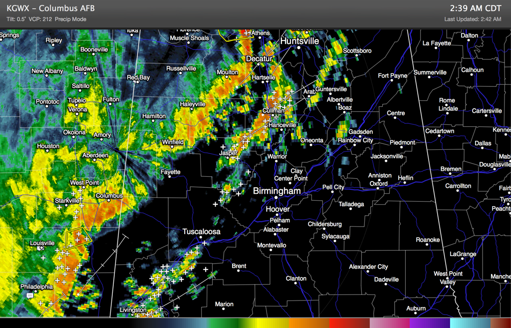
Storms continue across the northwestern half of Alabama early this Friday morning.
A nearly solid squall line extends from west of Athens to Winfield to Columbus MS. Ahead of this, scattered to fairly numerous storms continue in a line from Cullman to Jasper to Tuscaloosa to Demopolis.
Everything is moving east while individual cells move northeast.
The heaviest cells are in West Alabama over Sumter, Greene and Hale Counties. The storms from Cullman into northern Walker are packing a punch as well. Storms approaching Pickens County in about an hour will have to be watched as well. Lots of lightning, very heavy rain and the chance of a damaging wind gust or two in the stronger storms.
We can’t rule out an isolated warning or two, but he chance is slowly diminishing with time.
There has been very little damage in Alabama. The exception, some wind damage in Red Bay in Franklin County just after 1 a.m.
Category: Alabama's Weather, Severe Weather
About the Author (Author Profile)
Bill Murray is the President of The Weather Factory. He is the site's official weather historian and a weekend forecaster. He also anchors the site's severe weather coverage. Bill Murray is the proud holder of National Weather Association Digital Seal #0001 @wxhistorianSubscribe
If you enjoyed this article, subscribe to receive more just like it.


