

Evening Update
We continue to monitor a few strong and locally severe storms across Alabama this evening. All storms this afternoon and evening have been confined to the northern third of the state and north of the Intestate 59 corridor. Storms today have been pulsing up in intensity for a few minutes but then pulsing down. Very strong and robust updrafts have been occurring with these storms and these storms have been producing very large hail in areas they have affected. Numerous reports of hail up to the size of golf balls across portions of Wintson, Walker, and Cullman counties. Storms continue to move off towards the east to northeast rapidly.
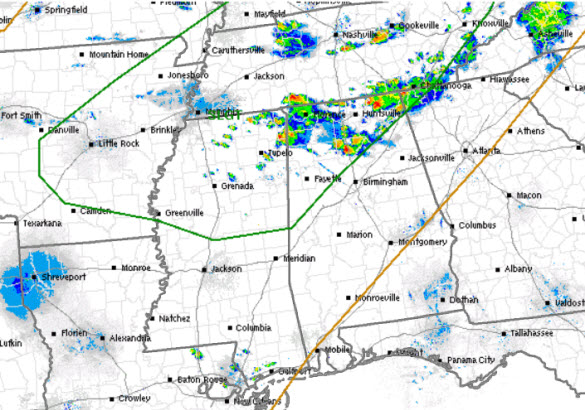
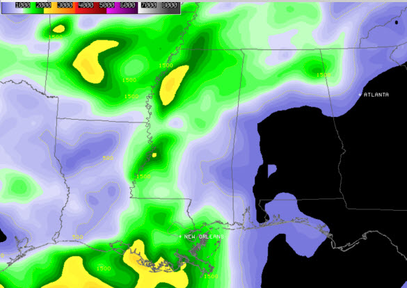
The SPC maintains much of North Alabama under a slight risk for severe weather through the overnight hours (areas outline in green above). Looking at the overall dynamics in the area below, there is ample CAPE in portions of Arkansas, Tennessee, and northern Mississippi. We are waiting to see if additional storms develop back to the northwest, and these will be watched carefully as instability remains robust in the areas outlined in the risk. However, as the sun sets, storm coverage and intensity should begin to diminish slowly as instability values decrease do to the loss of daytime heating. We should see storms last a few more hours, before winding down before midnight. Latest mesoscale discussion from the SPC suggest a severe weather watch will not be needed for this event across Alabama.
Category: Alabama's Weather, Severe Weather
About the Author (Author Profile)
Macon, Georgia Television Chief Meteorologist, Birmingham native, and long time Contributor on AlabamaWX. Stormchaser. I did not choose Weather, it chose Me. College Football Fanatic. @Ryan_StinnetSubscribe
If you enjoyed this article, subscribe to receive more just like it.


