

Higher Risk Of Storms Stays North
An all new edition of the ABC 33/40 Weather Xtreme video is available in the player on the right sidebar of the blog. You can subscribe to the Weather Xtreme video on iTunes by clicking here.
RADAR CHECK: The last batch of storms has moved out of Northeast Alabama at daybreak, and the weather is relatively quiet across Alabama with temperatures generally in the 60s.
LATER TODAY: The cold core, upper trough remains over the eastern third of the nation, and another wave rotating through the base of the trough is expected to kick off more showers and storms over North Alabama later this morning, but the high resolution HRRR model hints those storms will be mainly over the Tennessee Valley (below is model output valid at 11a CT)…
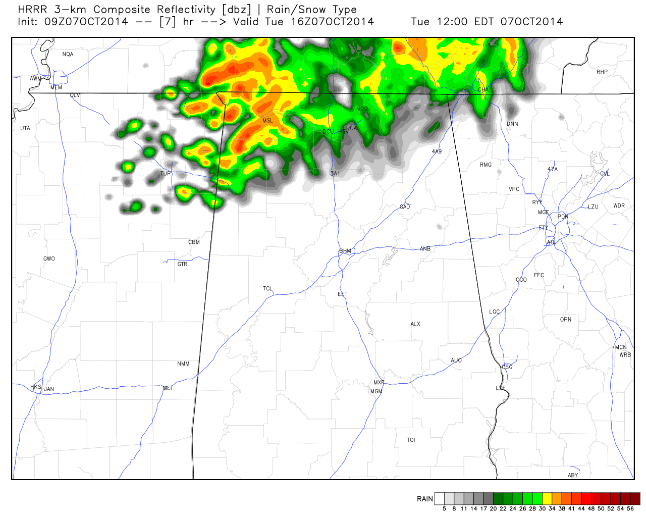
The bottom line is that the risk of rain now looks small today for places like Tuscaloosa, Birmingham and Anniston… highest risk of a shower or storm will be along and north of U.S. 278 (Hamilton to Cullman to Gadsden).
We will see a mix of sun and clouds, and temperatures should reach the low 80s this afternoon.
REST OF THE WEEK: A relatively moist air mass will remain in place, so we can’t rule out a few widely scattered showers or storms tomorrow and Thursday, but widespread rain is not expected. The sky will be partly sunny with a high up in the mid 80s.
Friday looks generally warm and dry; temperatures will rise into the mid 80s again, with potential even for upper 80s in a few spots. A cold front to the north will bring a risk of showers and storms to Kentucky and Tennessee, but new model guidance hints that front will stall out around I-40 in Tennessee, well to the north of Alabama. This means there is a pretty good chance we won’t have to deal with rain for the high school football games Friday night, with the exception of stadiums up near the Tennessee border.
THE ALABAMA WEEKEND: With the front stalling out over Tennessee, it looks now like the weekend will be mostly dry and warm for North/Central Alabama. Showers are possible mainly over the Tennessee Valley of far North Alabama; afternoon highs will remain very warm for October, with mid 80s likely Saturday and Sunday. The GFS does show the front nudging down to the south Monday of next week, with a better chance of showers and storms down to I-20, but the activity will be scattered. See the Weather Xtreme video for the maps, graphics, and more details.
TROPICS: All remains quiet, and tropical storm formation is not expected this week. The GFS continues to show some Gulf of Mexico mischief in about a week, but that remains to be seen if anything can actually develop there.
NATIONAL SHRIMP FESTIVAL: Perfect weather in Gulf Shores for the big event Thursday through Saturday. Sunny warm days, fair pleasant highs. Highs in the 80s, lows in the 60s. Could not be better.
WEATHER BRAINS: Don’t forget you can listen to our weekly 90 minute netcast anytime on the web, or on iTunes. This is the show all about weather featuring many familiar voices, including our meteorologists here at ABC 33/40. Scroll down for the show notes on the new episode we recorded last night.
CONNECT: You can find me on all of the major social networks…
Facebook
Twitter
Google Plus
Instagram
I will be speaking today at St. Martin’s In The Pines, a retirement community in the eastern part of Birmingham. Look for the next Weather Xtreme video here by 4:00 this afternoon… enjoy the day!
Category: Alabama's Weather
About the Author (Author Profile)
James Spann is one of the most recognized and trusted television meteorologists in the industry. He holds the AMS CCM designation and television seals from the AMS and NWA. He is a past winner of the Broadcast Meteorologist of the Year from both professional organizations.Subscribe
If you enjoyed this article, subscribe to receive more just like it.


