

Evening Radar Check
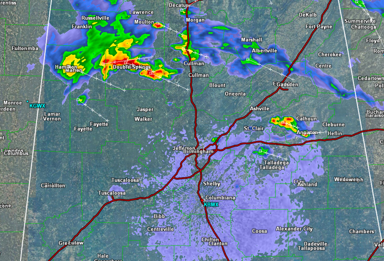
A boundary over the northern part of the state is the focal point for convection this evening. We have seen a few severe storms, but at this time, none of the storms are severe. However, these storms are packing a punch as they are producing intense lightning, very heavy rainfall, gusty winds, and some hail.
The storms are tracking towards the southeast, and will persist for a few more hours. The bulk of the activity has been north of Interstate 20, and that is where it will stay the next few hours, but areas east of Interstate 65 could see storms impact areas south of I-20.
Click image to enlarge.
Category: Alabama's Weather
About the Author (Author Profile)
Macon, Georgia Television Chief Meteorologist, Birmingham native, and long time Contributor on AlabamaWX. Stormchaser. I did not choose Weather, it chose Me. College Football Fanatic. @Ryan_StinnetSubscribe
If you enjoyed this article, subscribe to receive more just like it.


