Big Changes Early Next Week
An all new edition of the ABC 33/40 Weather Xtreme video is available in the player on the right sidebar of the blog. You can subscribe to the Weather Xtreme video on iTunes by clicking here.
WARM THROUGH THE WEEKEND: Alabama’s weather won’t change much through the weekend; an upper ridge will keep highs in the 80s through Sunday, and there will be sufficient moisture for the daily risk of scattered, mostly afternoon and evening showers and storms mainly along and north of I-20. The southern half of Alabama will remain warm and mostly dry.
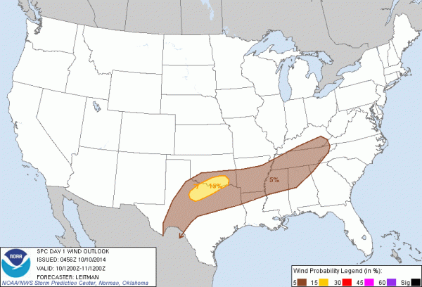
We do note SPC has a low end five percent severe weather possibility defined over North Alabama today and tonight, so where storms do form they could be strong.
NEXT WEEK: A long wave, vigorous upper trough will impact our state early next week, setting up the potential for strong to severe storms by Monday night. A deep surface low will be over Arkansas late Monday, with a tight pressure gradient in place across the state. This means Monday will be warm, breezy day before the storms arrive.
The main limiting factor for severe weather is the lack of surface based instability (CAPE values under 750 j/kg), and the lack of dry air in the mid levels. But, we all know we can have some pretty rough storms around here in the cool season even with marginal surface based CAPE values.
The low level jet (around 5,000 feet) will be screaming, with winds in excess of 60 knots forecast over North Alabama.
The latest GFS runs suggest a squall line will move through the state with potential for damaging straight line winds, and maybe even an embedded tornado since low level bulk shear values will very high. The main window for this line will come from about 9:00 p.m. Monday through 6:00 a.m. Tuesday. We will keep a close eye on model runs over the weekend and make adjustments in this forecast as needed.
Cooler, drier air will follow the storms Tuesday, and we should drop into the 40s by Wednesday and Thursday morning. See the Weather Xtreme video for the maps, graphics, and more details.
FOOTBALL WEATHER: For the high school games tonight; widely scattered showers and storms are possible from Birmingham north during the games, with dry conditions south of Birmingham. Temperatures will fall through the 70s.
Tomorrow, Auburn will take on the Mississippi State Bulldogs in Starkville (2:30p kickoff). The sky will be partly sunny with a kickoff temperature near 84 degrees; a passing shower or thunderstorm is possible during the game. Temperatures will fall to near 80 degrees by the final whistle.
Alabama will be on the road as well; they play Arkansas at Fayetteville (5:00p kickoff). The weather will be cool and wet with rain and storms likely…. temperatures will hover in the mid to upper 50s during the game. Take the rain gear.
UAB will celebrate homecoming tomorrow; the Blazers host North Texas (2:30p kickoff) at Legion Field. The sky will be partly sunny, and temperatures will fall from near 84 degrees at kickoff to around 80 by the fourth quarter. We can’t rule out a passing shower or thunderstorm, but rain will not be widespread.
NATIONAL SHRIMP FESTIVAL: Delightful weather for the big event at Gulf Shores through Sunday. Mostly sunny warm days, fair nights. Highs in the 80s, lows in the 60s.
TROPICS: A disturbance northeast of Puerto Rico is getting better organized, and could become a tropical storm, or a sub-tropical storm over the weekend. It will recurve harmlessly into the open Atlantic and is no threat to land. The rest of the Atlantic basin is very quiet.
WEATHER BRAINS: Don’t forget you can listen to our weekly 90 minute netcast anytime on the web, or on iTunes. This is the show all about weather featuring many familiar voices, including our meteorologists here at ABC 33/40.
CONNECT: You can find me on all of the major social networks…
Facebook
Twitter
Google Plus
Instagram
I will be at a UAB safety fair today on their campus… and tonight I will be speaking at an event at the Cullman Civic Center. But I will have time to crank out an afternoon Weather Xtreme video; it will be posted here by 4:00… enjoy the day!
Category: Alabama's Weather


