

Severe Thunderstorm Warning for Marengo Until 2:30 p.m.

Strong storms are lifting northward across South Alabama this afternoon and some of them are becoming severe in an increasingly ripe environment for severe weather.
There ispplenty of instability and bulk wind shear for strong and organized updrafts.
This environment will continue to become increasingly unstable through the afternoon.
In addition, the squall line is moving a little faster, and will be approaching West Alabama as early as 5 p.m.
We will be tracking the severe weather situation throughout the afternoon and evening and overnight.
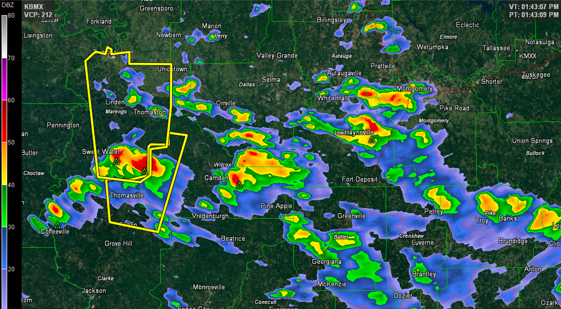
THE NATIONAL WEATHER SERVICE IN BIRMINGHAM HAS ISSUED A
* SEVERE THUNDERSTORM WARNING FOR…
MARENGO COUNTY IN SOUTHWEST ALABAMA…
* UNTIL 230 PM CDT
* AT 138 PM CDT…THE NATIONAL WEATHER SERVICE INDICATED A SEVERE
THUNDERSTORM CAPABLE OF PRODUCING QUARTER SIZE HAIL…AND DAMAGING
WINDS IN EXCESS OF 60 MPH. THIS STORM WAS LOCATED NEAR VINELAND…
OR 22 MILES SOUTH OF LINDEN…AND MOVING NORTH AT 45 MPH.
* LOCATIONS IMPACTED INCLUDE…
LINDEN…DEMOPOLIS…DIXONS MILL…SURGINER…SWEET WATER…
WAYNE…SHILOH AND MAGNOLIA.
Category: Alabama's Weather, Severe Weather
About the Author (Author Profile)
Subscribe
If you enjoyed this article, subscribe to receive more just like it.


