

Intense Storms About to Move into Birmingham
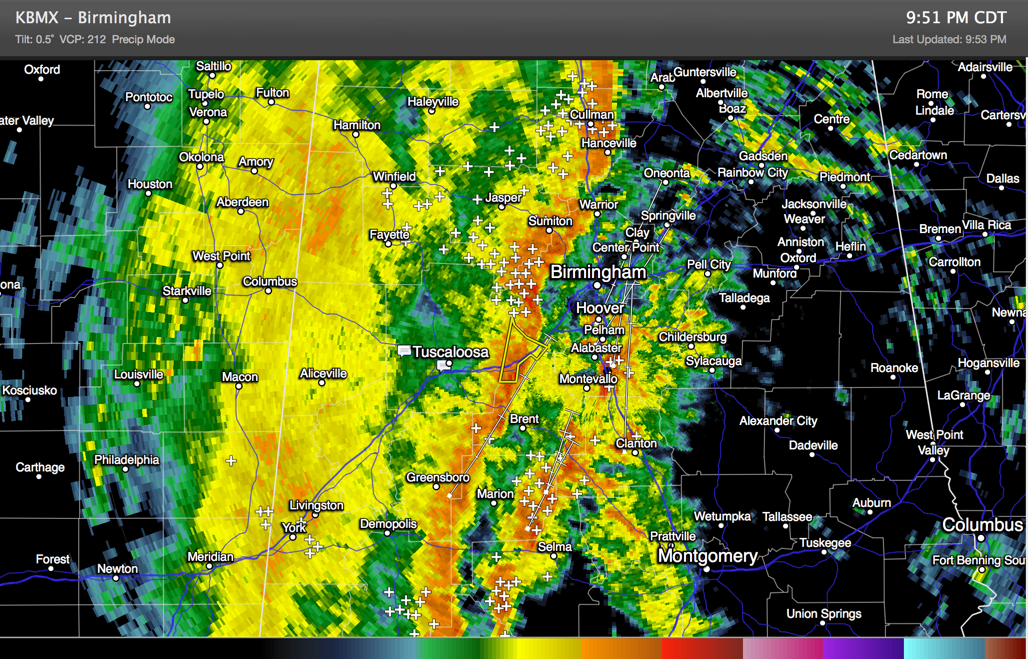
Strong thunderstorms are moving into the Birmingham Metro area now. There is no warning for Jefferson County at this time but a tornado watch remains in effect until midnight and the storms could become severe at any time.
In any case, they will produce winds of 50 mph or greater, torrential rain and lots of dangerous lightning.
They are now over western Jefferson County west of Bessemer and Birminghamport.
They will be in Bessemer a little after 10 p.m. and in downtown Birmingham, Homewood and Hoover between 10:15-10:30. Eastern and northern parts of Jefferson County will see them after 10:30.
Some counties are being trimmed from the tornado watch now:
The watch has been canceled for Greene, Sumter, Walker and Winston.
It continues for Autauga, Bibb, Blount, Chilton, Dallas, Etowah, Hale, Jefferson, Lowndes, Marengo, Perry, Shelby, St. Clair and Tuscaloosa.
Category: Alabama's Weather, Severe Weather
About the Author (Author Profile)
Bill Murray is the President of The Weather Factory. He is the site's official weather historian and a weekend forecaster. He also anchors the site's severe weather coverage. Bill Murray is the proud holder of National Weather Association Digital Seal #0001 @wxhistorianSubscribe
If you enjoyed this article, subscribe to receive more just like it.


