

Sunny Sunday
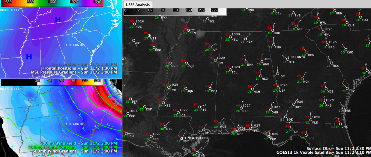
Looking at the weather maps today, we see surface high pressure dominating the eastern half of the U.S. That 1033 millibar high (translation=pretty strong) is centered from southern Kentucky to Central Mississippi. In the mid levels and upper levels of the atmosphere, we see a big wave pattern, with a trough over the eastern U.S., a ridge in the middle and a trough in the West. Clouds that were moving in from the northwest earlier have dried out as they pushed across Arkansas and western Tennessee into northern Mississippi. Hence they will not have much of an impact on our skies through the evening.
FIRST FREEZE OF SEASON AT BIRMINGHAM: It was a cold morning across Alabama with freezing temperatures generally north of I-59 and a few thrown in down into Southwest Alabama. Birmingham fell to 28F, while Calera was 6 degrees warmer at 34F. Tuscaloosa checked in with 30F and Anniston measured 29F. Interestingly, North Alabama readings were not substantially colder. Russellville won the cold weather lottery with 25F. The 28F at Birmingham was the coldest since March 26th and the first freeze since April 16th. Most folks should stay above freezing for the next few days with the exception of Eastern Alabama, where some freezing readings will likely drop below 32F tonight.
GETTING DARK EARLY TODAY: Sunset will come much earlier today because of the Daylight Saving Time change that occurred early this morning. Hopefully you weren’t an hour early for church or brunch! Highs this afternoon will rise into the upper 50s across the area. As mentioned early, most folks will be above freezing, in the 30s tonight, except for places like Gadsden, Fort Payne and Anniston in East Alabama. But look for frost still across much of the area anyway as grass and exposed automobiles fall to below freeze after dew forms.
SUNSHINE AHEAD: Plenty of sun in the forecast for Monday and Tuesday. And that surface high will slide east, giving us southerly surface winds by morning. That means moderating temperatures. With lots of sunshine, highs on Monday will be in the middle 60s with upper 60s to near 70F by Tuesday.
MIDWEEK WET WEATHER SYSTEM: Showers and storms will enter Northwest Alabama ahead of a cold front Wednesday night and will push southeastward through the state overnight. It should be weakening as it pushes toward I-59, but it will bring a soaking rain to the area late Wednesday night and early Thursday. Don’t look for great amounts of rainfall. Average amounts should be around a quarter of an inch. The GFS is a little slower with the system’s exit , keeping rain in the forecast deeper into the day on Thursday. Expect a high near 70F on Wednesday, but readings will fall back into the lower 60s on Thursday and be limited to the 50s on Friday. Lows will drop to around 40F by Friday morning.
Category: Alabama's Weather
About the Author (Author Profile)
Bill Murray is the President of The Weather Factory. He is the site's official weather historian and a weekend forecaster. He also anchors the site's severe weather coverage. Bill Murray is the proud holder of National Weather Association Digital Seal #0001 @wxhistorianSubscribe
If you enjoyed this article, subscribe to receive more just like it.


